Latitude: 54.2541 / 54°15'14"N
Longitude: -1.1851 / 1°11'6"W
OS Eastings: 453186
OS Northings: 484574
OS Grid: SE531845
Mapcode National: GBR NM57.6S
Mapcode Global: WHD8K.RBVL
Plus Code: 9C6W7R37+JW
Entry Name: Hambleton House
Listing Date: 14 March 1986
Grade: II
Source: Historic England
Source ID: 1191133
English Heritage Legacy ID: 328487
ID on this website: 101191133
Location: Cold Kirby, North Yorkshire, YO7
County: North Yorkshire
District: Ryedale
Civil Parish: Cold Kirby
Traditional County: Yorkshire
Lieutenancy Area (Ceremonial County): North Yorkshire
Church of England Parish: Upper Ryedale
Church of England Diocese: York
Tagged with: House
NORTH YORKSHIRE RYEDALE 5340
SE 58 SW COLD KIRBY MAIN STREET (north side)
8/12 Hambleton House
GV II
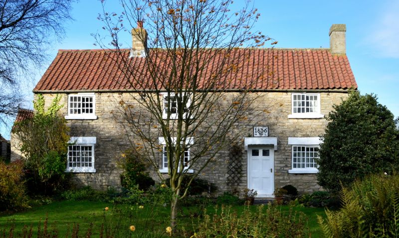
House. 1836 on datestone. Limestone rubble brought to course, pantile roof. 3-cell direct entry with single-cell parallel range under M-shaped roof to rear. 6-panel door with cornice and datestone above. 2-light small-paned Yorkshire sashes throughout. Ridge stack and rebuilt right end stack. Included for group considerations.
Listing NGR: SE5318684574
External links are from the relevant listing authority and, where applicable, Wikidata. Wikidata IDs may be related buildings as well as this specific building. If you want to add or update a link, you will need to do so by editing the Wikidata entry.


Other nearby listed buildings