Latitude: 53.483 / 53°28'58"N
Longitude: -1.2285 / 1°13'42"W
OS Eastings: 451296
OS Northings: 398749
OS Grid: SK512987
Mapcode National: GBR MXV5.V5
Mapcode Global: WHDD7.3Q97
Plus Code: 9C5WFQMC+5J
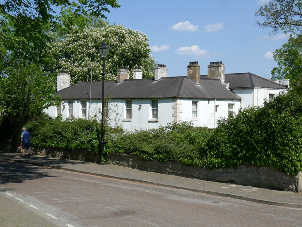
Entry Name: The Priory (Offices of Local Authority Department)
Listing Date: 5 November 1962
Last Amended: 26 November 1987
Grade: II
Source: Historic England
Source ID: 1192845
English Heritage Legacy ID: 334801
ID on this website: 101192845
Location: Conisbrough, Doncaster, South Yorkshire, DN12
County: Doncaster
Electoral Ward/Division: Conisbrough
Parish: Non Civil Parish
Built-Up Area: Conisbrough
Traditional County: Yorkshire
Lieutenancy Area (Ceremonial County): South Yorkshire
Church of England Parish: Conisbrough St Peter
Church of England Diocese: Sheffield
Tagged with: Architectural structure
CONISBR0UGH HIGH STREET SK59NW (east side)
4/28 The Priory (offices of 5.11.62 Local Authority Housing Department) (formerly listed as Priory House).
GV II
House now local authority offices. Early-mid C19. Ruled stucco, Welsh slate roof. 2-storey, 3-bay front with wing across rear projecting beyond right return. Giant end pilasters and raised central bays Rectangular stone steps to central door with fanlight in doorcase having keyed archivolt and modillioned pediment. Outer bays each have a canted bay window with sashes and modillioned cornice. 1st floor: plain central sash with projecting sill in segmentally-arched recess rising from doorcase; outer bays have similar paired sashes. Cornice, breaking forward over ends and centre, beneath parapet with balustraded panels over each bay. Hipped roof with stacks to rear, at junction with lower wing, and on ridge of rear wing.
Listing NGR: SK5129898751
External links are from the relevant listing authority and, where applicable, Wikidata. Wikidata IDs may be related buildings as well as this specific building. If you want to add or update a link, you will need to do so by editing the Wikidata entry.


Other nearby listed buildings