Latitude: 51.5505 / 51°33'1"N
Longitude: -1.149 / 1°8'56"W
OS Eastings: 459102
OS Northings: 183859
OS Grid: SU591838
Mapcode National: GBR 91L.QBR
Mapcode Global: VHCYW.19F6
Plus Code: 9C3WHV22+6C
Entry Name: Moulsford Grange and Attached Wall
Listing Date: 9 April 1952
Last Amended: 13 January 1986
Grade: II
Source: Historic England
Source ID: 1193850
English Heritage Legacy ID: 248008
ID on this website: 101193850
Location: Moulsford, South Oxfordshire, OX10
County: Oxfordshire
District: South Oxfordshire
Civil Parish: Moulsford
Built-Up Area: Moulsford
Traditional County: Berkshire
Lieutenancy Area (Ceremonial County): Oxfordshire
Tagged with: Architectural structure
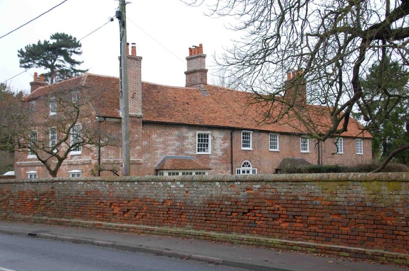
MOULSFORD THE STREET SU5983 (East side) 10/124 Moulsford Grange and attached 09/04/52 wall (Formerly listed as Moulsford Grange) GV II
House. Late C17 with C20 addition to right. Red brick with grey brick headers in Flemish bond; old plain-tile double-depth roof half-hipped to left; brick ridge stacks. 2-storey, 4-window range at right-angles to street. 6-panel part-glazed door with fan-light and flanking single-lights to centre. Late C19 bays with sashes and hipped plain-tile roofs to left and right. Four 16-pane sashes to first floor. Left return: 2 storey and attic. 3-window range. Bricked doorway to centre, French windows to left and right. Moulded brick band between ground and first floor. 12-pane sash to first floor centre. 16-pane sashes to left and right. Single leaded-light window to centre of half-gable to attic with 2-light leaded casement to left and right. Interior not inspected. C20 addition to right of 2 storeys. 2-window range. Attached boundary wall of red brick with half-round coping.
Listing NGR: SU5910283859
External links are from the relevant listing authority and, where applicable, Wikidata. Wikidata IDs may be related buildings as well as this specific building. If you want to add or update a link, you will need to do so by editing the Wikidata entry.


Other nearby listed buildings