Latitude: 51.5502 / 51°33'0"N
Longitude: -1.1494 / 1°8'57"W
OS Eastings: 459074
OS Northings: 183816
OS Grid: SU590838
Mapcode National: GBR 91L.Q7L
Mapcode Global: VHCYW.196H
Plus Code: 9C3WHV22+36
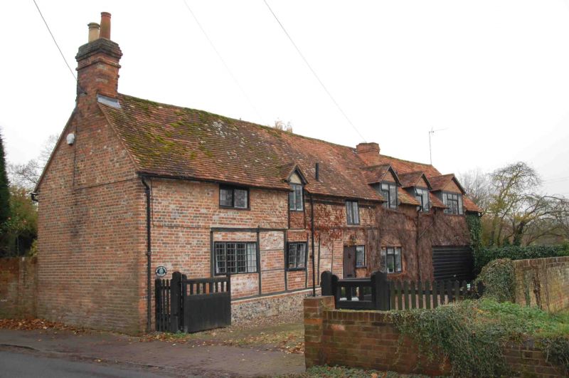
Entry Name: Kates Cottage
Listing Date: 13 January 1986
Grade: II
Source: Historic England
Source ID: 1193878
English Heritage Legacy ID: 248013
ID on this website: 101193878
Location: Moulsford, South Oxfordshire, OX10
County: Oxfordshire
District: South Oxfordshire
Civil Parish: Moulsford
Built-Up Area: Moulsford
Traditional County: Berkshire
Lieutenancy Area (Ceremonial County): Oxfordshire
Tagged with: Cottage
MOULSFORD THE STREET
SU5983
(West side)
10/129
Kates Cottage
GV II
Shown on O.S. map as Chestnut Cottage.
House. Mid C18 with C20 addition to right. Flint base; irregular timber framing
with red brick infill; old plain-tile roof; brick end stacks. 2-storey, 3-window
range at right-angles to street. Plank door to right. 2-light leaded wood
casements to centre. 4-light leaded wood casement to left. Central gabled
half-dormer to first floor centre with 2-light wood casement. 2-light casements
to left and right. Interior not inspected. Included for group value.
Listing NGR: SU5907483816
External links are from the relevant listing authority and, where applicable, Wikidata. Wikidata IDs may be related buildings as well as this specific building. If you want to add or update a link, you will need to do so by editing the Wikidata entry.


Other nearby listed buildings