Approximate Location Map
Large Map »
Latitude: 50.8368 / 50°50'12"N
Longitude: -0.7724 / 0°46'20"W
OS Eastings: 486539
OS Northings: 104857
OS Grid: SU865048
Mapcode National: GBR DGS.HJV
Mapcode Global: FRA 968W.GX4
Plus Code: 9C2XR6PH+P2
Entry Name: 150, St Pancras
Listing Date: 8 October 1971
Grade: II
Source: Historic England
Source ID: 1194383
English Heritage Legacy ID: 300123
ID on this website: 101194383
Location: Chichester, West Sussex, PO19
County: West Sussex
District: Chichester
Civil Parish: Chichester
Built-Up Area: Chichester
Traditional County: Sussex
Lieutenancy Area (Ceremonial County): West Sussex
Church of England Parish: Chichester St Pancras
Church of England Diocese: Chichester
Tagged with: Building
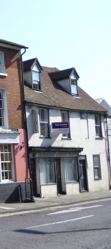
ST PANCRAS
1.
972
(South-East Side)
No 150
SU 8604 NE 20/549
II GV
C18. 2 storeys. 4 windows (1 blocked). Tiled gabled roof.
Cemented. Sash windows with flush boxes; glazing bars missing.
C19 shop front on ground floor.
Nos 147 to 150 (consec) form a group.
Listing NGR: SU8653904857
External links are from the relevant listing authority and, where applicable, Wikidata. Wikidata IDs may be related buildings as well as this specific building. If you want to add or update a link, you will need to do so by editing the Wikidata entry.


Other nearby listed buildings
