Approximate Location Map
Large Map »
Latitude: 51.9737 / 51°58'25"N
Longitude: 0.7771 / 0°46'37"E
OS Eastings: 590843
OS Northings: 234220
OS Grid: TL908342
Mapcode National: GBR RKP.C7V
Mapcode Global: VHKFJ.FN5B
Plus Code: 9F32XQFG+FR
Entry Name: The Manse
Listing Date: 9 February 1978
Grade: II
Source: Historic England
Source ID: 1194700
English Heritage Legacy ID: 277892
ID on this website: 101194700
Location: Bures, Babergh, Suffolk, CO8
County: Suffolk
District: Babergh
Civil Parish: Bures St. Mary
Built-Up Area: Bures
Traditional County: Suffolk
Lieutenancy Area (Ceremonial County): Suffolk
Church of England Parish: Bures St Mary
Church of England Diocese: St.Edmundsbury and Ipswich
Tagged with: Clergy house
HIGH STREET
1.
5377 (North-West Side)
Bures St Mary
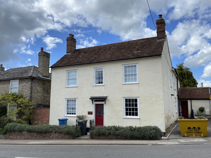
The Manse
TL 9034 26/95
II GV
2.
An early C19 timber-framed and plastered house, scratch lined as ashlar.
2 storeys. 3 window range, double-hung sashes with glazing bars. A central
doorway has a flat hood on brackets. Roof tiled.
Listing NGR: TL9084334220
External links are from the relevant listing authority and, where applicable, Wikidata. Wikidata IDs may be related buildings as well as this specific building. If you want to add or update a link, you will need to do so by editing the Wikidata entry.


Other nearby listed buildings
