Latitude: 52.9283 / 52°55'42"N
Longitude: -0.6327 / 0°37'57"W
OS Eastings: 492009
OS Northings: 337645
OS Grid: SK920376
Mapcode National: GBR DPY.GVF
Mapcode Global: WHGKH.7NZF
Plus Code: 9C4XW9H8+8W
Entry Name: 16, High Road
Listing Date: 21 September 1979
Grade: II
Source: Historic England
Source ID: 1194835
English Heritage Legacy ID: 382898
ID on this website: 101194835
Location: Manthorpe, South Kesteven, Lincolnshire, NG31
County: Lincolnshire
District: South Kesteven
Civil Parish: Belton and Manthorpe
Built-Up Area: Grantham
Traditional County: Lincolnshire
Lieutenancy Area (Ceremonial County): Lincolnshire
Church of England Parish: Grantham Manthorpe
Church of England Diocese: Lincoln
Tagged with: Building
BELTON & MANTHORPE SK9237 HIGH ROAD, Manthorpe 1315-0/11/121 (South East side) 21/09/79 No.16 GV II
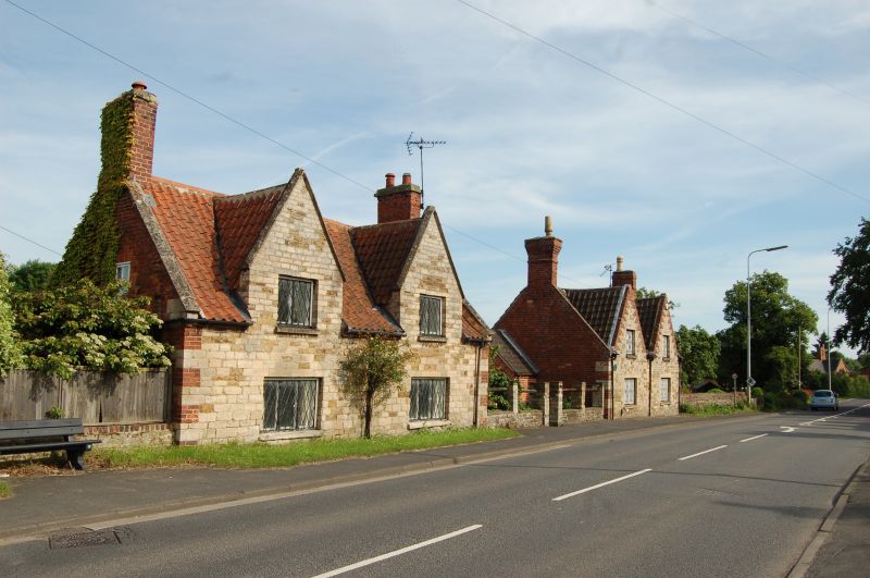
Estate cotttage, now a house. Mid C19, with late C20 alterations. Coursed squared stone with brick gables, ashlar and brick dressings, and steep pitched renewed pantile roof. 2 coped brick gable stacks. Mid C18 vernacular style, imitating the adjacent No 17 (qv). Coped gables. 2 storeys; 2 window range. Windows are mainly casements with C19 cast-iron diamond pane glazing. 2 front gables, each with a 2-light window, and below, a 3-light window. An estate cottage provided for workers on the Belton estate by the Brownlow family of Belton Hall. (The Buildings of England: Pevsner N, Harris J & Antram N: Lincolnshire: London: 1964-1989: 550).
Listing NGR: SK9201637646
External links are from the relevant listing authority and, where applicable, Wikidata. Wikidata IDs may be related buildings as well as this specific building. If you want to add or update a link, you will need to do so by editing the Wikidata entry.


Other nearby listed buildings