Latitude: 54.0486 / 54°2'54"N
Longitude: -2.8025 / 2°48'8"W
OS Eastings: 347554
OS Northings: 461702
OS Grid: SD475617
Mapcode National: GBR 8PWM.2F
Mapcode Global: WH846.XHNM
Plus Code: 9C6V25XX+C2
Entry Name: John O' Gaunt Public House
Listing Date: 9 July 1974
Last Amended: 13 March 1995
Grade: II
Source: Historic England
Source ID: 1194968
English Heritage Legacy ID: 383203
ID on this website: 101194968
Location: Lancaster, Lancashire, LA1
County: Lancashire
District: Lancaster
Electoral Ward/Division: Castle
Parish: Non Civil Parish
Built-Up Area: Lancaster
Traditional County: Lancashire
Lieutenancy Area (Ceremonial County): Lancashire
Church of England Parish: Lancaster St Mary with St John and St Anne
Church of England Diocese: Blackburn
Tagged with: Pub
LANCASTER
SD4761NE MARKET STREET 1685-1/7/170 (South side) 09/07/74 Nos.55 AND 57 John O' Gaunt Public House (No.55) (Formerly Listed as: MARKET STREET Nos.53, 53A, 55 AND 57 John O'Gaunt Inn (55))
GV II
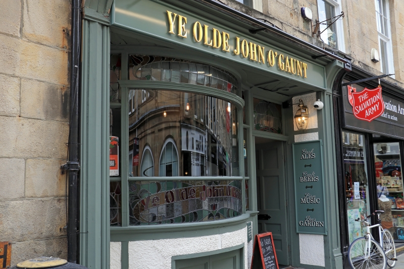
House, now public house and shop. Early C19, altered C20. Sandstone ashlar with slate roof. 3 storeys and 3 bays under a cornice. The 2nd-floor windows have projecting sills and those on the 1st floor have a sill band. Their glazing bar sashes are mainly altered: the right-hand (3rd) window on the 2nd floor has a lower sash without glazing bars, as do the 1st and 2nd windows on the 1st floor. The 3rd window on the 1st floor has had its lower sash replaced by a casement. On the ground floor are 2 timber shop fronts with fascias. Recessed into the left-hand one is an early C20 public house front, with a doorway to the right of a bowed window which contains stained glass and has a low cellar doorway immediately below.
Listing NGR: SD4755461702
External links are from the relevant listing authority and, where applicable, Wikidata. Wikidata IDs may be related buildings as well as this specific building. If you want to add or update a link, you will need to do so by editing the Wikidata entry.


Other nearby listed buildings