Latitude: 54.0506 / 54°3'2"N
Longitude: -2.806 / 2°48'21"W
OS Eastings: 347329
OS Northings: 461922
OS Grid: SD473619
Mapcode National: GBR 8PVL.9R
Mapcode Global: WH846.WG03
Plus Code: 9C6V352V+6J
Entry Name: Sundial Approximately 15 Metres South of Tower of Priory Church of St Mary
Listing Date: 13 March 1995
Grade: II
Source: Historic England
Source ID: 1195070
English Heritage Legacy ID: 383263
ID on this website: 101195070
Location: Lancaster, Lancashire, LA1
County: Lancashire
District: Lancaster
Electoral Ward/Division: Castle
Parish: Non Civil Parish
Built-Up Area: Lancaster
Traditional County: Lancashire
Lieutenancy Area (Ceremonial County): Lancashire
Church of England Parish: Lancaster St Mary with St John and St Anne
Church of England Diocese: Blackburn
Tagged with: Sundial
LANCASTER
SD4761NW PRIORY CHURCHYARD 1685-1/6/230 Sundial approx. 15 metres south of tower of Priory Church of St Mary
GV II
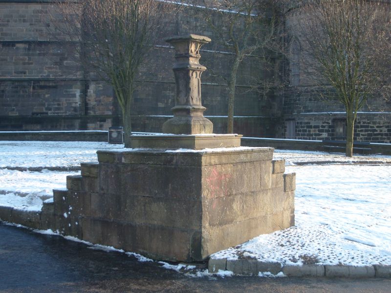
Sundial. Late C18 and restored in 1894. Sandstone ashlar. Gothick style. Square in plan with stepped base. The steps all have nosings and the number of steps varies on each side: only the east side has a full flight of 6 steps reaching the ground. Each face of the shaft has, above the plinth, a panel set between a pair of ogee mouldings and bearing an elongated quatrefoil. This is topped by the square base of the dial, which is concave in profile and also bears 8 quatrefoils, one on each of the cardinal faces and 4 around the corners. The bronze gnomon and dial, inscribed with Roman numerals and the text 'SIC UMBRA VERTIT, SIC VITA FUGIT', were removed and stored after being vandalised.
Listing NGR: SD4732961922
External links are from the relevant listing authority and, where applicable, Wikidata. Wikidata IDs may be related buildings as well as this specific building. If you want to add or update a link, you will need to do so by editing the Wikidata entry.


Other nearby listed buildings