Latitude: 51.5349 / 51°32'5"N
Longitude: -0.1032 / 0°6'11"W
OS Eastings: 531654
OS Northings: 183484
OS Grid: TQ316834
Mapcode National: GBR N3.ZY
Mapcode Global: VHGQT.5P96
Plus Code: 9C3XGVMW+XP
Entry Name: 9, 11 and 13, Charlton Place
Listing Date: 29 September 1972
Last Amended: 30 September 1994
Grade: II
Source: Historic England
Source ID: 1195523
English Heritage Legacy ID: 368697
ID on this website: 101195523
Location: Islington, London, N1
County: London
District: Islington
Electoral Ward/Division: St Peter's
Parish: Non Civil Parish
Built-Up Area: Islington
Traditional County: Middlesex
Lieutenancy Area (Ceremonial County): Greater London
Church of England Parish: St James Prebend Street
Church of England Diocese: London
Tagged with: Building
ISLINGTON
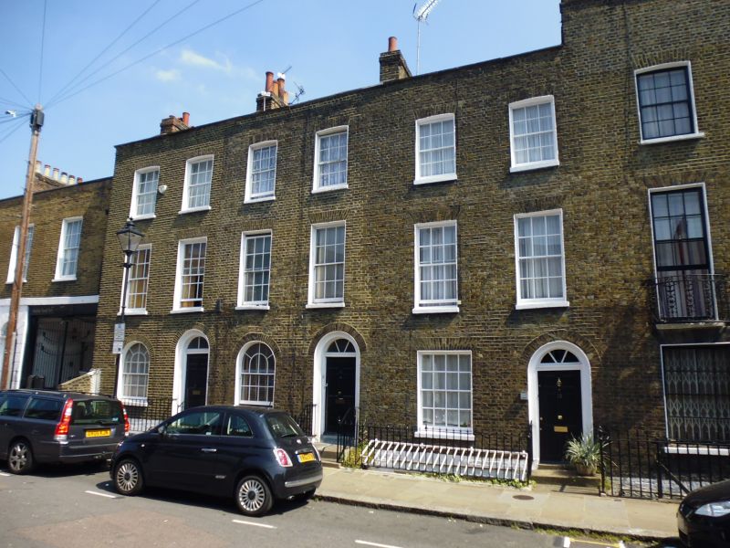
TQ3183SE CHARLTON PLACE 635-1/65/207 (North side) 29/09/72 Nos.9, 11 AND 13 (Formerly Listed as: CHARLTON PLACE Nos.7-15, 19-25 (Odd))
GV II
Terraced houses. 1790. Developed by James Taylor. Yellow brick set in Flemish bond, roof obscured by parapet. Three storeys over basement, two windows each. All openings have gauged brick heads. Round-arched entrance set in recessed, round-arched stucco panel with cornice and fanlight. Ground-floor window to nos 9 and 11 round-arched, to no 13 flat-arched; first-floor window flat-arched, those on second floor cambered. Sashes of original design to no 11 (second floor), 13 (ground and second floor). Parapet. Stacks to projecting party walls. (Eric Willatts: Streets with a story. The book of Islington: London: 1986-).
Listing NGR: TQ3165483484
External links are from the relevant listing authority and, where applicable, Wikidata. Wikidata IDs may be related buildings as well as this specific building. If you want to add or update a link, you will need to do so by editing the Wikidata entry.


Other nearby listed buildings