Latitude: 51.5243 / 51°31'27"N
Longitude: -0.106 / 0°6'21"W
OS Eastings: 531490
OS Northings: 182298
OS Grid: TQ314822
Mapcode National: GBR N7.BR
Mapcode Global: VHGQT.3YTC
Plus Code: 9C3XGVFV+PH
Entry Name: School Keeper's House, Kingsway College Clerkenwell Centre
Listing Date: 29 September 1972
Last Amended: 30 September 1994
Grade: II
Source: Historic England
Source ID: 1195751
English Heritage Legacy ID: 369338
ID on this website: 101195751
Location: Clerkenwell, Islington, London, EC1R
County: London
District: Islington
Electoral Ward/Division: Clerkenwell
Parish: Non Civil Parish
Built-Up Area: Islington
Traditional County: Middlesex
Lieutenancy Area (Ceremonial County): Greater London
Church of England Parish: St James Clerkenwell
Church of England Diocese: London
Tagged with: Architectural structure
ISLINGTON
TQ3182SW SANS WALK 635-1/73/754 (North side) 29/09/72 School Keeper's House, Kingsway College Clerkenwell Centre (Formerly Listed as: SKINNER STREET (South side) Prison governor's house (now School Keeper's House))
GV II
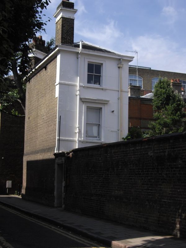
Former chief warder's house of the Middlesex House of Detention, now school keeper's house; built into the wall at the south-west corner of the former prison yard. 1845-7. By William Moseley. Brick covered with stucco to school yard, brown brick set in English bond to rear, hipped roof of Welsh slate. Three storeys, two-window range to north. The west bay projects considerably. Segmental-arched entrance with panelled doorcase and fanlight; stucco storey band between ground and first floors and stucco sill bands to first and second floors. All windows flat-arched, those to the ground floor with chamfered reveals, those to upper floors with moulded architraves, and cornices to first floor. Two-storey bay to west wing. Moulded eaves cornice. Stacks at south-east and south-west corners. The rear, to Sans Walk and Clerkenwell Close, is a blank elevation of brick stepped slightly in at plinth level and between ground and first floors. (Historians' file, English Heritage London Division).
Listing NGR: TQ3149082298
External links are from the relevant listing authority and, where applicable, Wikidata. Wikidata IDs may be related buildings as well as this specific building. If you want to add or update a link, you will need to do so by editing the Wikidata entry.


Other nearby listed buildings