Latitude: 51.5348 / 51°32'5"N
Longitude: -0.1051 / 0°6'18"W
OS Eastings: 531524
OS Northings: 183473
OS Grid: TQ315834
Mapcode National: GBR N3.KZ
Mapcode Global: VHGQT.4P97
Plus Code: 9C3XGVMV+WX
Entry Name: 38, Upper Street
Listing Date: 13 June 1989
Last Amended: 30 September 1994
Grade: II
Source: Historic England
Source ID: 1195771
English Heritage Legacy ID: 369397
ID on this website: 101195771
Location: Islington, London, N1
County: London
District: Islington
Electoral Ward/Division: St Mary's
Parish: Non Civil Parish
Built-Up Area: Islington
Traditional County: Middlesex
Lieutenancy Area (Ceremonial County): Greater London
Church of England Parish: St Mary Islington
Church of England Diocese: London
Tagged with: Building
ISLINGTON
TQ3183SE UPPER STREET 635-1/65/868 (West side) 13/06/89 No.38 (Formerly Listed as: UPPER STREET Nos.37 & 38)
II
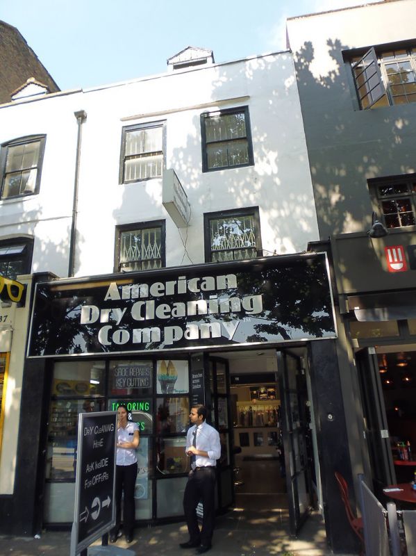
Terraced house, now shop. Early C18, altered. Brick covered with plaster, roof of tiles; C18 brick stack to rear. Three storeys with dormer in attic, two-window range. Ground floor has C20 shop front; first-floor windows flat-arched and apparently of C20 date; some form of dripmould over second-floor windows; parapet; mansard roof with gabled dormers; C18 brick stack to rear. INTERIOR: has central winder staircase, and ogee-stopped chamfered beams to first- and second-floor front rooms, which also have C18 panelled dados.
Listing NGR: TQ3152483473
External links are from the relevant listing authority and, where applicable, Wikidata. Wikidata IDs may be related buildings as well as this specific building. If you want to add or update a link, you will need to do so by editing the Wikidata entry.


Other nearby listed buildings