Latitude: 54.8861 / 54°53'9"N
Longitude: -2.9212 / 2°55'16"W
OS Eastings: 341001
OS Northings: 554982
OS Grid: NY410549
Mapcode National: GBR 8C1Y.C8
Mapcode Global: WH803.3G63
Plus Code: 9C6VV3PH+CG
Entry Name: The Railway Inn
Listing Date: 24 May 1993
Grade: II
Source: Historic England
Source ID: 1196925
English Heritage Legacy ID: 386783
ID on this website: 101196925
Location: Cumberland, Cumbria, CA1
County: Cumberland
District: Carlisle
Parish: Non Civil Parish
Built-Up Area: Carlisle
Traditional County: Cumberland
Lieutenancy Area (Ceremonial County): Cumbria
Church of England Parish: Carlisle St John the Evangelist
Church of England Diocese: Carlisle
Tagged with: Inn
CARLISLE
NY45SW LONDON ROAD 671-1/16/193 (West side) 24/05/93 No.104 The Railway Inn
II
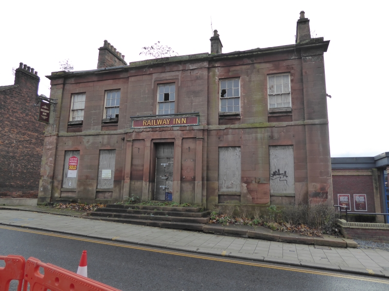
Hotel, now public house. 1837. Red sandstone ashlar on squared plinth with angle pilaster strips, string course, cornice and partial solid parapet. Graduated greenslate roof with coped gables; ridge and end ashlar chimney stacks. 2 storeys, 5 bays, double-depth plan. Central raised bay has panelled door and patterned overlight, up steps in pilastered surround (formerly had a tetrastyle portico removed in early C20). Sash windows with glazing bars in plain stone reveals with recessed panelled aprons that over entrance in stone architraves. Plastic canopies over ground floor windows. INTERIOR not inspected. Built to serve the London Road Station of the Newcastle & Carlisle Railway opposite, now demolished. Referred to as the "new" Railway Hotel in Carlisle Journal (1837). At one time it had an attached bowling green, shown on the 1842 Map of Carlisle. (Carlisle Journal: 16 December 1837).
Listing NGR: NY4100154982
External links are from the relevant listing authority and, where applicable, Wikidata. Wikidata IDs may be related buildings as well as this specific building. If you want to add or update a link, you will need to do so by editing the Wikidata entry.


Other nearby listed buildings