Latitude: 54.8881 / 54°53'17"N
Longitude: -2.9245 / 2°55'28"W
OS Eastings: 340791
OS Northings: 555213
OS Grid: NY407552
Mapcode National: GBR 8C0X.NJ
Mapcode Global: WH803.1DNJ
Plus Code: 9C6VV3QG+75
Entry Name: St Nicholas Arms Public House
Listing Date: 11 April 1994
Grade: II
Source: Historic England
Source ID: 1297405
English Heritage Legacy ID: 386782
Also known as: St Nicholas Arms
ID on this website: 101297405
Location: Carlisle, Cumberland, Cumbria, CA1
County: Cumberland
District: Carlisle
Parish: Non Civil Parish
Built-Up Area: Carlisle
Traditional County: Cumberland
Lieutenancy Area (Ceremonial County): Cumbria
Church of England Parish: Carlisle St John the Evangelist
Church of England Diocese: Carlisle
Tagged with: Pub
CARLISLE
NY4055 LONDON ROAD 671-1/11/192 (East side) 13/11/72 No.47 St Nicholas Arms Public House
GV II
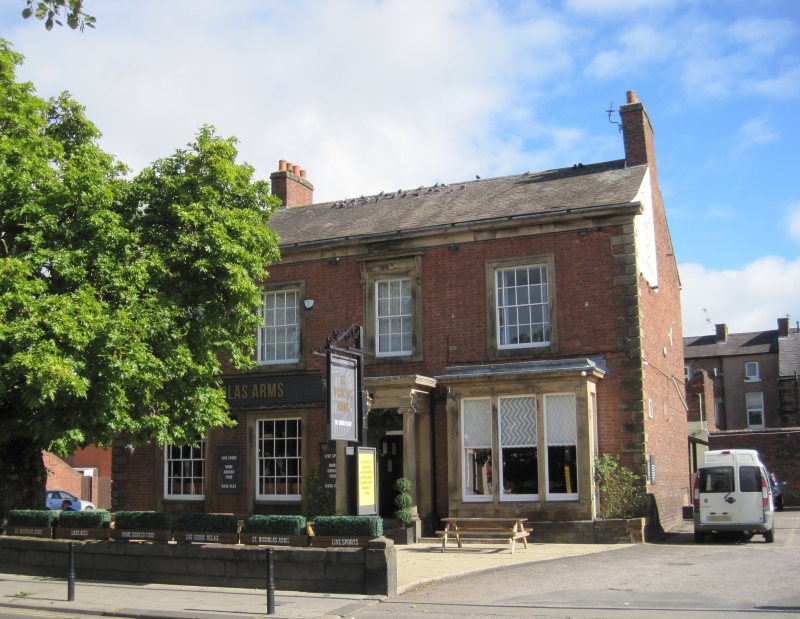
House, now public house. Early C19. Flemish bond brickwork on chamfered plinth, with V-jointed quoins (all dressings of calciferous sandstone) and eaves cornice. Graduated greenslate roof; original end brick chimney stacks. 2 storeys, 4 bays; double-depth plan. Off-centre panelled door and overlight, up steps, in prostyle Ionic porch. Right squared bay window in stone surround. Other windows are sashes with glazing bars in stone architraves, that over entrance with bracketed cornice, larger ground-floor windows with panelled aprons. C20 plastic inn signboard and oval signs flanking an upper floor window. INTERIOR not inspected. Appears on 1842 Map of Carlisle. Opened as a pub under State Management control in 1921, see Carlisle Journal (1921). (Carlisle Journal: 22 July 1921: P.7).
Listing NGR: NY4079155213
External links are from the relevant listing authority and, where applicable, Wikidata. Wikidata IDs may be related buildings as well as this specific building. If you want to add or update a link, you will need to do so by editing the Wikidata entry.


Other nearby listed buildings