Latitude: 52.6338 / 52°38'1"N
Longitude: -1.6926 / 1°41'33"W
OS Eastings: 420903
OS Northings: 304054
OS Grid: SK209040
Mapcode National: GBR 4FD.YQD
Mapcode Global: WHCH3.Z254
Plus Code: 9C4WJ8M4+GX
Entry Name: 10, Colehill
Listing Date: 9 November 1972
Grade: II
Source: Historic England
Source ID: 1197047
English Heritage Legacy ID: 386470
ID on this website: 101197047
Location: Tamworth, Staffordshire, B79
County: Staffordshire
District: Tamworth
Electoral Ward/Division: Castle
Parish: Non Civil Parish
Built-Up Area: Tamworth
Traditional County: Warwickshire
Lieutenancy Area (Ceremonial County): Staffordshire
Church of England Parish: Tamworth St Editha
Church of England Diocese: Lichfield
Tagged with: Building
TAMWORTH
SK2004SE COLEHILL 670-1/7/64 (East side) 09/11/72 No.10
GV II
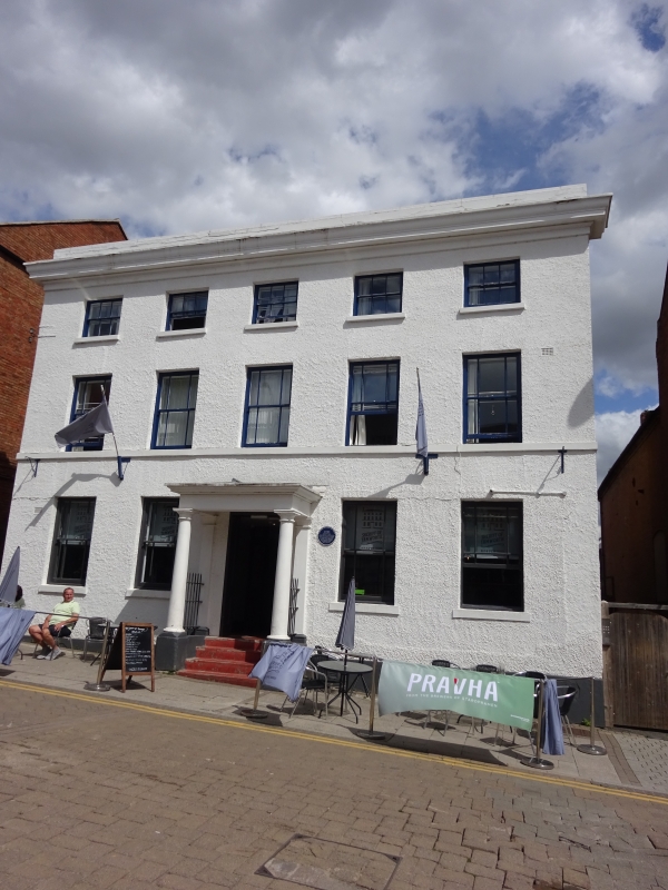
House, now office. Probably C17, refronted early C19. Pebbledashed brick with ashlar dressings, some internal timber frame; parapeted roof. Double-depth plan with rear wing. 3 storeys; symmetrical 5-window range. Entrance has Tuscan porch, columns on plinths, with steps to small-paned half-glazed door. Windows have sills and horned sashes with margin lights, smaller windows to 2nd floor. Rear wing with large cross-axial stack. INTERIOR: exposed timber-framing, especially to upper floors; attic has exposed C17 brickwork and queen-strut trusses; central open-well stair with column-on-vase balusters, square newels and ramped handrails. The home of General Bailey Willington, 1755-1822, an artillery commander at the siege of Gibraltar, 1782.
Listing NGR: SK2090304054
External links are from the relevant listing authority and, where applicable, Wikidata. Wikidata IDs may be related buildings as well as this specific building. If you want to add or update a link, you will need to do so by editing the Wikidata entry.


Other nearby listed buildings