Latitude: 52.6338 / 52°38'1"N
Longitude: -1.6924 / 1°41'32"W
OS Eastings: 420912
OS Northings: 304046
OS Grid: SK209040
Mapcode National: GBR 4FD.YRQ
Mapcode Global: WHCH3.Z276
Plus Code: 9C4WJ8M5+G2
Entry Name: 11, Colehill
Listing Date: 28 February 1992
Grade: II
Source: Historic England
Source ID: 1207981
English Heritage Legacy ID: 386471
ID on this website: 101207981
Location: Tamworth, Staffordshire, B79
County: Staffordshire
District: Tamworth
Electoral Ward/Division: Castle
Parish: Non Civil Parish
Built-Up Area: Tamworth
Traditional County: Warwickshire
Lieutenancy Area (Ceremonial County): Staffordshire
Church of England Parish: Tamworth St Editha
Church of England Diocese: Lichfield
Tagged with: Building
TAMWORTH
SK2004SE COLEHILL 670-1/7/65 (East side) No.11
GV II
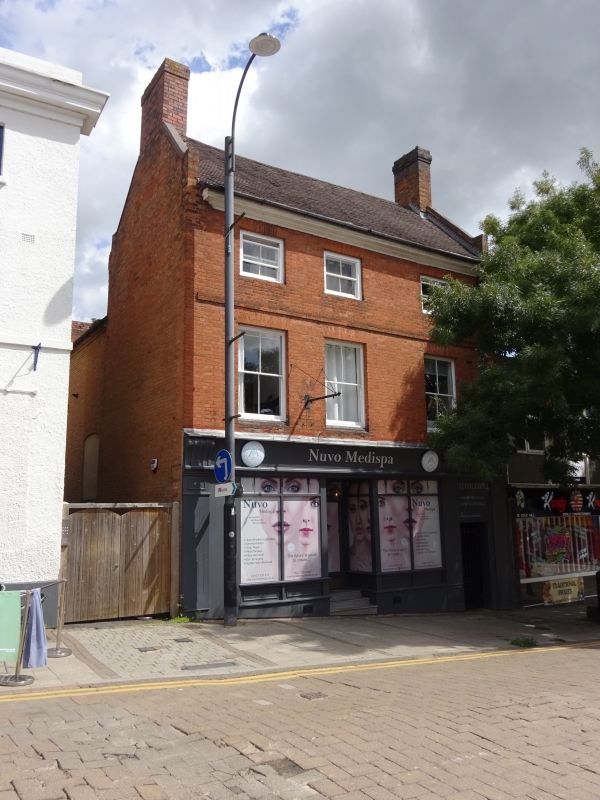
House, now shop. Mid to late C18. Brick; tile roof with brick end stacks. L-plan. 3 storeys; 3-window range. Platt band over 1st floor and top wooden cornice; coped gables. Ground floor has C20 shop front with entrance to right. 1st and 2nd floor windows have rubbed brick flat arches, over 4-pane sashes to 1st floor, smaller 4-pane horned sashes to 2nd floor. 2-storey rear wing. Interior not inspected.
Listing NGR: SK2091204046
External links are from the relevant listing authority and, where applicable, Wikidata. Wikidata IDs may be related buildings as well as this specific building. If you want to add or update a link, you will need to do so by editing the Wikidata entry.


Other nearby listed buildings