Latitude: 54.1888 / 54°11'19"N
Longitude: -3.2048 / 3°12'17"W
OS Eastings: 321482
OS Northings: 477674
OS Grid: SD214776
Mapcode National: GBR 6N10.Z5
Mapcode Global: WH723.RZ35
Plus Code: 9C6R5QQW+G3
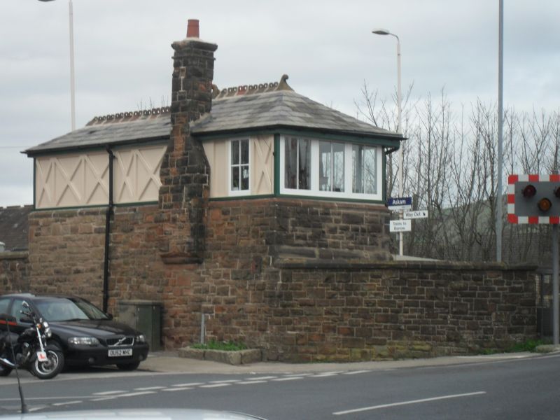
Entry Name: Signal Box and Attached Walling at Askam in Furness Railway Station
Listing Date: 31 January 1989
Grade: II
Source: Historic England
Source ID: 1197891
English Heritage Legacy ID: 388443
ID on this website: 101197891
Location: Askam in Furness, Westmorland and Furness, Cumbria, LA16
County: Westmorland and Furness
District: Barrow-in-Furness
Civil Parish: Askam and Ireleth
Built-Up Area: Askam in Furness
Traditional County: Lancashire
Lieutenancy Area (Ceremonial County): Cumbria
Church of England Parish: Dalton-in-Furness St Mary
Church of England Diocese: Carlisle
Tagged with: Signal box
BARROW IN FURNESS
SD27NW DUDDON ROAD, Askam In Furness 708-1/1/144 (North side) 31/01/89 Signal box and attached walling at Askam in Furness Railway Station
GV II
Signal box and attached walling. Late C19. Red sandstone rubble, the box part-glazed and part-timbered, slate roof with terracotta cresting. Walls enclose south-west end of platform with the box at the angle. Wall with chamfered coping. Box: 1 storey with basement, 3 basement windows on platform side, glazed box with cross-timbered panel to east, north door reached by external steps and external corbelled stack on west side; hipped roof. These structures form a group with other station buildings (qv).
Listing NGR: SD2148277674
External links are from the relevant listing authority and, where applicable, Wikidata. Wikidata IDs may be related buildings as well as this specific building. If you want to add or update a link, you will need to do so by editing the Wikidata entry.


Other nearby listed buildings