Latitude: 53.4814 / 53°28'53"N
Longitude: -2.2465 / 2°14'47"W
OS Eastings: 383737
OS Northings: 398326
OS Grid: SJ837983
Mapcode National: GBR DJH.70
Mapcode Global: WHB9G.GRGG
Plus Code: 9C5VFQJ3+H9
Entry Name: 19, King Street
Listing Date: 6 June 1994
Grade: II
Source: Historic England
Source ID: 1197935
English Heritage Legacy ID: 388233
ID on this website: 101197935
Location: Manchester, Greater Manchester, M2
County: Manchester
Electoral Ward/Division: City Centre
Parish: Non Civil Parish
Built-Up Area: Manchester
Traditional County: Lancashire
Lieutenancy Area (Ceremonial County): Greater Manchester
Church of England Parish: Manchester St Ann
Church of England Diocese: Manchester
Tagged with: Building
MANCHESTER
SJ8398SE KING STREET 698-1/27/180 (North side) No.19
GV II
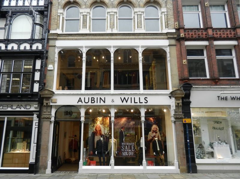
Shop. c.1880, altered. Yellow brick with sandstone dressings, slate roof. Rectangular plan at right-angles to street. Four storeys. C20 shop-front at ground floor; an arcaded range of 4-light windows on each upper floor: slim cast-iron columns at 1st floor with arched open-work brackets, round-headed windows to 2nd floor with set-in shafts, enriched imposts and linked hoodmoulds with large mask keystones (male and female alternately, all cheerful and stylish); shouldered windows to 3rd floor; parapet.
Listing NGR: SJ8373898327
External links are from the relevant listing authority and, where applicable, Wikidata. Wikidata IDs may be related buildings as well as this specific building. If you want to add or update a link, you will need to do so by editing the Wikidata entry.


Other nearby listed buildings