Latitude: 51.0893 / 51°5'21"N
Longitude: -2.2704 / 2°16'13"W
OS Eastings: 381158
OS Northings: 132253
OS Grid: ST811322
Mapcode National: GBR 0V3.NSF
Mapcode Global: FRA 6647.MBK
Plus Code: 9C3V3PQH+PR
Entry Name: Charnel House in the Churchyard of the Church of St Michael
Listing Date: 6 January 1966
Grade: II
Source: Historic England
Source ID: 1200069
English Heritage Legacy ID: 320169
ID on this website: 101200069
Location: Mere, Wiltshire, BA12
County: Wiltshire
Civil Parish: Mere
Built-Up Area: Mere
Traditional County: Wiltshire
Lieutenancy Area (Ceremonial County): Wiltshire
Church of England Parish: Mere St Michael the Archangel
Church of England Diocese: Salisbury
Tagged with: Architectural structure
ST 8032-8132 MERE CHURCH STREET (south side) 6/40 Charnel House in the 6.1.66 churchyard of the Church of St Michael
GV II
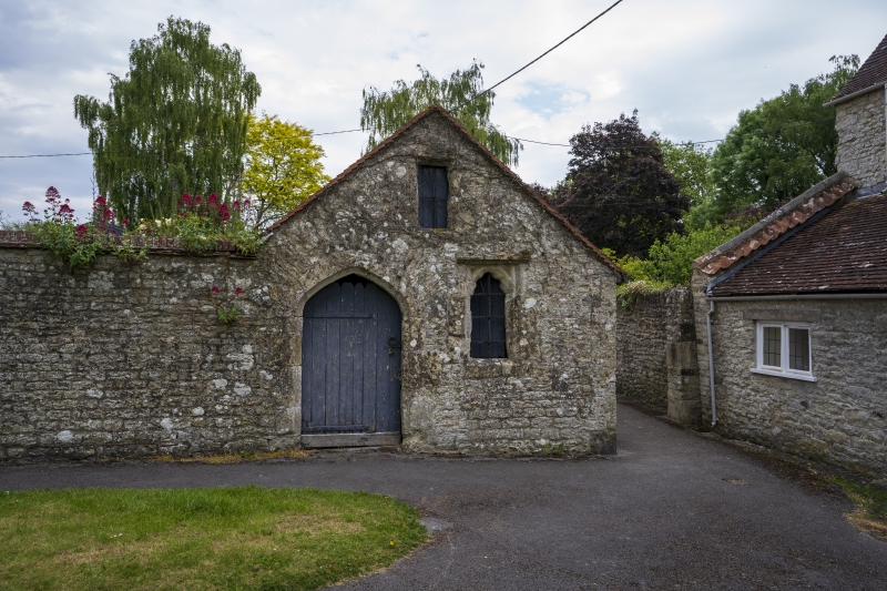
Churchyard building, possibly former charnel house, now store. Late mediaeval front, much reconstructed behind. Squared limestone rubble in courses, plain tile roof to tight-clipped verge; red brick dressing and quoins on north side. To churchyard a flat segmental chamfered opening with C19 plank door; to the right a worn cusped single light with terracotta beneath a section of straight hollow mould as drip, and in the gable a plain rectangular opening to chamfered surround. Left wall has a late opening with plank fill right wall plain. Roof structure rebuilt in C19 or C20. To the right a rubble wall continues at eaves height to a returned garden wall.
Listing NGR: ST8115632253
External links are from the relevant listing authority and, where applicable, Wikidata. Wikidata IDs may be related buildings as well as this specific building. If you want to add or update a link, you will need to do so by editing the Wikidata entry.


Other nearby listed buildings