Latitude: 53.48 / 53°28'48"N
Longitude: -2.2281 / 2°13'41"W
OS Eastings: 384957
OS Northings: 398166
OS Grid: SJ849981
Mapcode National: GBR DNH.6H
Mapcode Global: WHB9G.RS5J
Plus Code: 9C5VFQJC+2Q
Entry Name: Stable Block to South East of Junction Works at Paradise Wharf
Listing Date: 6 June 1994
Grade: II
Source: Historic England
Source ID: 1200857
English Heritage Legacy ID: 388111
ID on this website: 101200857
Location: Ancoats, Manchester, Greater Manchester, M1
County: Manchester
Electoral Ward/Division: Ancoats and Clayton
Parish: Non Civil Parish
Built-Up Area: Manchester
Traditional County: Lancashire
Lieutenancy Area (Ceremonial County): Greater Manchester
Church of England Parish: Manchester St Ann
Church of England Diocese: Manchester
Tagged with: Stable
MANCHESTER
SJ8498SE DUCIE STREET 698-1/29/121 (South side) Stable block to south east of Junction Works at Paradise Wharf
GV II
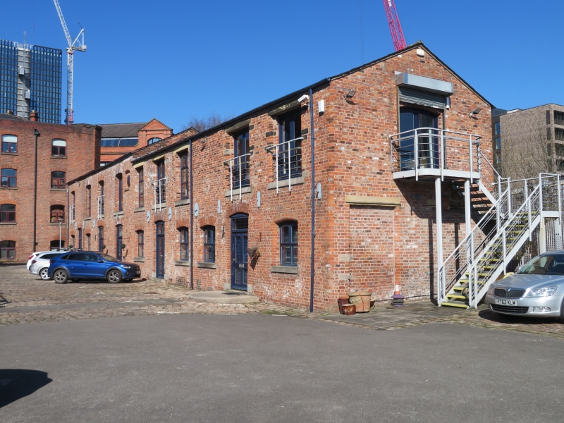
Stable block to former lead works, restoration in progress at time of survey. Early to mid C19, altered. Red brick in English garden wall bond, slate roof. Rectangular plan. Two storeys, 4+5 windows, the further portion slightly lower; 3 segmental-headed stable doorways to the first portion and 2 in the other, all with altered doors; segmental-headed windows at 1st floor of the first portion, square-headed windows to the other, all with restored sills and the latter with restored lintels (glazing removed at time of survey). Small segmental-headed blind window at right-hand end of first portion. Left (north) gable wall has 2 low segmental-headed windows set high to ground floor and restored or inserted loft doorway above. Included for group value.
Listing NGR: SJ8495798166
External links are from the relevant listing authority and, where applicable, Wikidata. Wikidata IDs may be related buildings as well as this specific building. If you want to add or update a link, you will need to do so by editing the Wikidata entry.


Other nearby listed buildings