Latitude: 53.3862 / 53°23'10"N
Longitude: -3.0251 / 3°1'30"W
OS Eastings: 331919
OS Northings: 388193
OS Grid: SJ319881
Mapcode National: GBR 7Y98.WW
Mapcode Global: WH87D.H4QX
Plus Code: 9C5R9XPF+FX
Entry Name: 42, Clifton Road
Listing Date: 28 March 1974
Grade: II
Source: Historic England
Source ID: 1201606
English Heritage Legacy ID: 389168
ID on this website: 101201606
Location: Tranmere, Wirral, Merseyside, CH41
County: Wirral
Electoral Ward/Division: Birkenhead and Tranmere
Parish: Non Civil Parish
Built-Up Area: Birkenhead
Traditional County: Cheshire
Lieutenancy Area (Ceremonial County): Merseyside
Church of England Parish: Tranmere St Catherine
Church of England Diocese: Chester
Tagged with: House
BIRKENHEAD
SJ3188 CLIFTON ROAD 789-1/11/57 (West side) 28/03/74 No.42
II
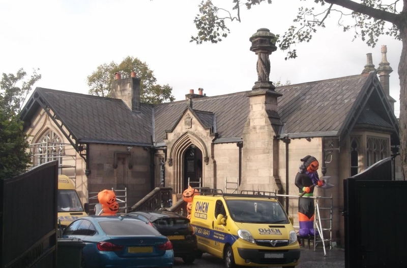
House. c1840-50. By Walter Scott. Ashlar-faced with Welsh slate roof. Single-storeyed, but full basement storey to rear of sloping site, asymmetrically planned in gothic style. Elevation to Hollybank Road has advanced gabled wing to the left with traceried Perpendicular style window with ogival hoodmould, and quatrefoil lancet on inner face. Quatrefoil panels in gable bargeboards. Stressed gable over doorway to right: paired panelled arched doors up steps with octagonal piers and fretted stone parapet. Elevation to Clifton Street has gable to left with shallow canted bay window with trefoiled lancets and hipped roof. Axial and side wall stacks, enriched with reeded flues, barley sugar swags and heavy octagonal caps. The house forms part of the original development of Clifton Park, laid out by Scott as a villa estate.
Listing NGR: SJ3191988193
External links are from the relevant listing authority and, where applicable, Wikidata. Wikidata IDs may be related buildings as well as this specific building. If you want to add or update a link, you will need to do so by editing the Wikidata entry.


Other nearby listed buildings