Latitude: 53.3853 / 53°23'7"N
Longitude: -3.0252 / 3°1'30"W
OS Eastings: 331910
OS Northings: 388098
OS Grid: SJ319880
Mapcode National: GBR 7Y99.V5
Mapcode Global: WH87D.H5NL
Plus Code: 9C5R9XPF+4W
Entry Name: Gate Piers to Numbers 47 and 49
Listing Date: 28 March 1974
Grade: II
Source: Historic England
Source ID: 1282591
English Heritage Legacy ID: 389170
ID on this website: 101282591
Location: Tranmere, Wirral, Merseyside, CH41
County: Wirral
Electoral Ward/Division: Birkenhead and Tranmere
Parish: Non Civil Parish
Built-Up Area: Birkenhead
Traditional County: Cheshire
Lieutenancy Area (Ceremonial County): Merseyside
Church of England Parish: Birkenhead Christ the King
Church of England Diocese: Chester
Tagged with: Gatepost
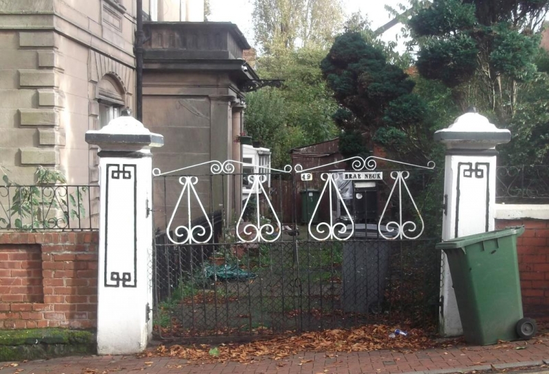
BIRKENHEAD
SJ3188 CLIFTON ROAD
789-1/11/59 Gate piers to Nos. 47 and 49
28/03/74
GV II
Pair of gate piers. c1847. Ashlar with incised decoration of
panels and shallow pyramidal caps.
Listing NGR: SJ3191088098
External links are from the relevant listing authority and, where applicable, Wikidata. Wikidata IDs may be related buildings as well as this specific building. If you want to add or update a link, you will need to do so by editing the Wikidata entry.


Other nearby listed buildings