Latitude: 52.5845 / 52°35'4"N
Longitude: -2.1372 / 2°8'14"W
OS Eastings: 390797
OS Northings: 298526
OS Grid: SO907985
Mapcode National: GBR 1BK.9X
Mapcode Global: WHBFZ.49JJ
Plus Code: 9C4VHVM7+Q4
Entry Name: Church of St Mark
Listing Date: 3 February 1977
Grade: II
Source: Historic England
Source ID: 1201793
English Heritage Legacy ID: 378355
Also known as: St Mark's Church, Chapel Ash
ID on this website: 101201793
Location: Wolverhampton, West Midlands, WV3
County: City of Wolverhampton
Electoral Ward/Division: Graiseley
Parish: Non Civil Parish
Built-Up Area: Wolverhampton
Traditional County: Staffordshire
Lieutenancy Area (Ceremonial County): West Midlands
Church of England Parish: Central Wolverhampton
Church of England Diocese: Lichfield
Tagged with: Church building
WOLVERHAMPTON
SO90NW CHAPEL ASH 895-1/5/208 (South side) 03/02/77 Church of St Mark
II
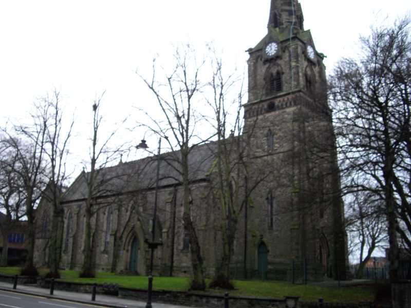
Church. 1848-9; chancel late C19; being converted to office use at time of resurvey (1990). By C.W.Orford; a Commissioners' church. Dressed squared stone with ashlar dressings; slate roofs. Apsed chancel has gabled vestry/organ loft projections; nave and gabled aisles; west steeple. Early English style. Shallow offset buttresses and coped gables with crosses. Chancel has 3 cusped lancets; projections have 2-light plate tracery windows and 2-light gableted east windows; trefoil window to nave east gable. 6-bay aisles have lancets with splayed reveals and hood moulds; north and south gabled porches have pointed entrances and lateral buttresses. 3-stage tower has plinth, foundation stone to south, angle buttresses; west entrance with triple-chamfered arch, south lancet and entrance; lancets to 2nd stage, top blind arcading; top stage has pilaster buttresses and corbel table, 2-light louvred plate-tracery bell openings; gableted clock faces; broach spire with beasts to angles and lucarnes. INTERIOR recorded as having arcades with thin pier, alternately octagonal and quatrefoil. An important landmark, especially for terminating view down Darlington St from Queen Square.
Listing NGR: SO9079798526
External links are from the relevant listing authority and, where applicable, Wikidata. Wikidata IDs may be related buildings as well as this specific building. If you want to add or update a link, you will need to do so by editing the Wikidata entry.


Other nearby listed buildings