Latitude: 52.5861 / 52°35'10"N
Longitude: -2.1256 / 2°7'32"W
OS Eastings: 391588
OS Northings: 298709
OS Grid: SO915987
Mapcode National: GBR 1DK.VB
Mapcode Global: WHBFZ.B827
Plus Code: 9C4VHVPF+CQ
Entry Name: 15, 16 and 17, King Street
Listing Date: 16 July 1949
Grade: II
Source: Historic England
Source ID: 1201823
English Heritage Legacy ID: 378442
ID on this website: 101201823
Location: Wolverhampton, West Midlands, WV1
County: City of Wolverhampton
Electoral Ward/Division: St Peter's
Parish: Non Civil Parish
Built-Up Area: Wolverhampton
Traditional County: Staffordshire
Lieutenancy Area (Ceremonial County): West Midlands
Church of England Parish: Central Wolverhampton
Church of England Diocese: Lichfield
Tagged with: Building
WOLVERHAMPTON
SO9198NE KING STREET 895-1/12/246 (North side) 16/07/49 Nos.15, 16 AND 17
GV II
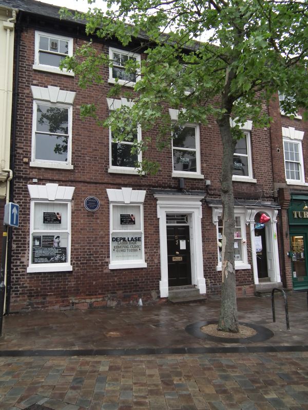
3 houses, now offices and shop. Late C18. Brick with stucco dressings; tile roof. Double-depth plan. 3 storeys; 6-window range. Top cornice, part modillioned, flat pilaster to left of 5th window. Windows have rusticated wedge lintels over late C19 sashes; 2nd floor has 6-pane sashes, glazing bars missing to lower sashes of first 4 bays. Entrance to No 15 has eared architrave, pulvinated frieze and cornice, overlight and panelled reveals; No 16 has round-headed entrance to right, fanlight with decorative glazing bars under consoled cornice; No 17 has C20 shop front. INTERIOR of No 16 has round-headed door with fanlight with glazing bars and stair with column-on-vase balusters. One of a row of Georgian houses in King Street, built after 1751. (Isaac Taylor: A Plan of Wolverhampton: London: 1750-1751).
Listing NGR: SO9158898709
External links are from the relevant listing authority and, where applicable, Wikidata. Wikidata IDs may be related buildings as well as this specific building. If you want to add or update a link, you will need to do so by editing the Wikidata entry.


Other nearby listed buildings