Latitude: 52.5964 / 52°35'46"N
Longitude: -2.1595 / 2°9'34"W
OS Eastings: 389289
OS Northings: 299852
OS Grid: SO892998
Mapcode National: GBR 15F.FN
Mapcode Global: WHBFR.SZTY
Plus Code: 9C4VHRWR+G5
Entry Name: Bredon House
Listing Date: 3 February 1977
Grade: II
Source: Historic England
Source ID: 1201882
English Heritage Legacy ID: 378600
ID on this website: 101201882
Location: Newbridge, Wolverhampton, West Midlands, WV6
County: City of Wolverhampton
Electoral Ward/Division: Park
Parish: Non Civil Parish
Built-Up Area: Wolverhampton
Traditional County: Staffordshire
Lieutenancy Area (Ceremonial County): West Midlands
Church of England Parish: Wolverhampton St Jude
Church of England Diocese: Lichfield
Tagged with: House
WOLVERHAMPTON
SO89NE TETTENHALL ROAD 895-1/4/90 (South side) 03/02/77 No.321 Bredon House
II
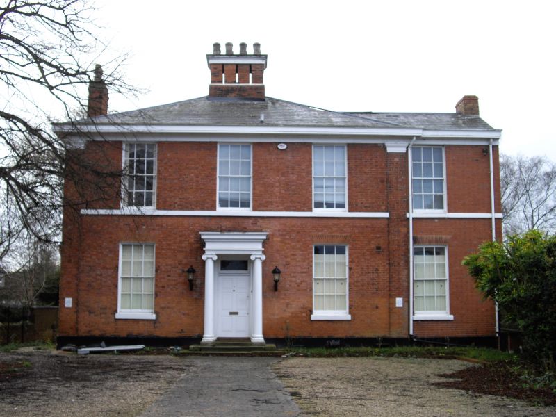
House, now office. c1810. Brick with ashlar dressings; hipped slate roof with brick stacks. Double-depth plan with rear wing. 2 storeys; symmetrical 3-window range with addition to right. 1st floor sill course; top frieze, cornice and boxed eaves; brick quoins. Windows have rubbed brick flat arches over 12-pane sashes; addition has similar window to both floors. Central entrance has architrave and Ionic porch, overlight and 6-fielded-panel door. Large brick stack with ashlar cap, smaller end stacks. Rear has similar details; short wing and attached 3-window range under hipped roof. House set back from road, possibly indicating original line of road before it was re-routed by T.Telford in 1820s.
Listing NGR: SO8928999852
External links are from the relevant listing authority and, where applicable, Wikidata. Wikidata IDs may be related buildings as well as this specific building. If you want to add or update a link, you will need to do so by editing the Wikidata entry.


Other nearby listed buildings