Latitude: 51.4945 / 51°29'40"N
Longitude: -2.6184 / 2°37'6"W
OS Eastings: 357162
OS Northings: 177469
OS Grid: ST571774
Mapcode National: GBR C23.T3
Mapcode Global: VH88F.KPLN
Plus Code: 9C3VF9VJ+RJ
Entry Name: 57 and 59, High Street
Listing Date: 30 December 1994
Grade: II
Source: Historic England
Source ID: 1202296
English Heritage Legacy ID: 379777
ID on this website: 101202296
Location: Westbury on Trym, Bristol, BS9
County: City of Bristol
Electoral Ward/Division: Westbury-on-Trym and Henleaze
Parish: Non Civil Parish
Built-Up Area: Bristol
Traditional County: Gloucestershire
Lieutenancy Area (Ceremonial County): Bristol
Church of England Parish: Westbury-on-Trym
Church of England Diocese: Bristol
Tagged with: Building
BRISTOL
ST5777 HIGH STREET, Westbury On Trym 901-1/26/2074 (West side) Nos.57 AND 59
GV II
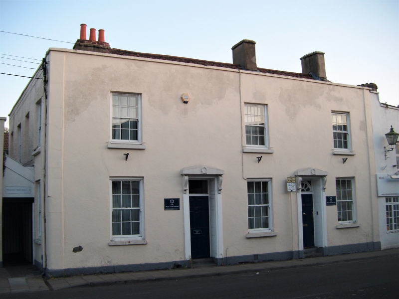
Pair of attached houses. Late C18, altered mid C19. Render with limestone dressings, gable and ridge stacks, and a pantile double-pile roof, hipped to the left. Double-depth plan. Mid Georgian style. 2 storeys; 3-window range. Plain pilasters to a parapet which extends round the left end, and coped right gable. Symmetrical left-hand house with 1-window range house added to the right, each has doorways set back with panelled reveals and soffits, 6-panel doors and fanlights, plate glass to No.57, and C19 brackets and pedimented lintels with wreaths. Horned 6/6-pane sashes, 1 to right of doorway of No.57; hornless sashes in the left return. INTERIOR: No.59, central through passage with one fully panelled wall, leading to a dogleg stair at the rear with stick balusters, column newels and ramped rails, vine cornice panels, C19 fireplaces, 4-panel shutters and 6-panel doors.
Listing NGR: ST5716277469
External links are from the relevant listing authority and, where applicable, Wikidata. Wikidata IDs may be related buildings as well as this specific building. If you want to add or update a link, you will need to do so by editing the Wikidata entry.


Other nearby listed buildings