Latitude: 51.4683 / 51°28'5"N
Longitude: -2.5838 / 2°35'1"W
OS Eastings: 359544
OS Northings: 174535
OS Grid: ST595745
Mapcode National: GBR CBD.LH
Mapcode Global: VH88N.5CD7
Plus Code: 9C3VFC98+8F
Entry Name: 133 and 135, York Road
Listing Date: 4 March 1977
Grade: II
Source: Historic England
Source ID: 1202733
English Heritage Legacy ID: 380955
ID on this website: 101202733
Location: Montpelier, Bristol, BS6
County: City of Bristol
Electoral Ward/Division: Ashley
Parish: Non Civil Parish
Built-Up Area: Bristol
Traditional County: Gloucestershire
Lieutenancy Area (Ceremonial County): Bristol
Church of England Parish: Bishopston and St Andrews
Church of England Diocese: Bristol
Tagged with: Building
BRISTOL
ST5974 YORK ROAD, Montpelier 901-1/36/1621 (North side) 04/03/77 Nos.133 AND 135
GV II
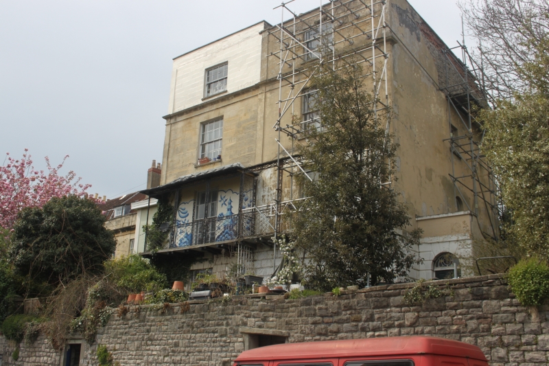
Pair of attached houses, now subdivided into flats. c1820. Limestone ashlar, roof not visible. Double-depth plan. Each of 3 storeys, basement and attic; 1-window range. Each house has a rusticated ground floor, pilasters and a cornice below the added attic storey; the entrance to No.135 is set back in a right-hand side block; semicircular-arched doorway to the right with rusticated voussoirs and tear-drop fanlight; 10/10-pane sashes to the ground and first floors, 8/8-panes above, and full-width first-floor wrought-iron tented verandah on cantilevered brackets. INTERIOR: right-hand hall to a fine lateral, curved open-well stair, and fielded shutters.
Listing NGR: ST5954474535
External links are from the relevant listing authority and, where applicable, Wikidata. Wikidata IDs may be related buildings as well as this specific building. If you want to add or update a link, you will need to do so by editing the Wikidata entry.


Other nearby listed buildings