Latitude: 50.5512 / 50°33'4"N
Longitude: -2.4298 / 2°25'47"W
OS Eastings: 369649
OS Northings: 72470
OS Grid: SY696724
Mapcode National: GBR PZ.39YB
Mapcode Global: FRA 57SL.Z3D
Plus Code: 9C2VHH2C+F3
Entry Name: Boundary Wall Along North Side
Listing Date: 17 May 1993
Grade: II
Source: Historic England
Source ID: 1203091
English Heritage Legacy ID: 381953
ID on this website: 101203091
Location: Grove, Dorset, DT5
County: Dorset
Civil Parish: Portland
Built-Up Area: Grove
Traditional County: Dorset
Lieutenancy Area (Ceremonial County): Dorset
Church of England Parish: Portland All Saints
Church of England Diocese: Salisbury
Tagged with: Wall
PORTLAND
SY67SE GROVE ROAD, Grove 969-1/1/131 (North side) Boundary wall along N side
GV II
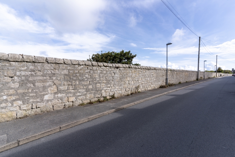
Boundary wall, enclosing quarry workings. C19. Rough coursed rubble to a flush rounded coping. The wall begins c 20m W from No 1, Grove Road, on the opposite side of the road and runs continuously c 400m to the E, returning to a gate pier (qv) at the entry to Incline Road. Height c 2.2m, the upper two courses of squared stone have been added at some stage to what was a lower wall; there is a break in construction opposite No 30, Grove Road, where a field boundary marks the edge of the quarry, and this is marked also by a boundary stone with incised anchor, one of a series of Admiralty markers on the island. The wall is important in establishing the identity and continuity of the street, which on its south side is contained by a continuous row of buildings; it also continues beyond the entry to Incline Road (see entry for Ivybank).
Listing NGR: SY6964972470
External links are from the relevant listing authority and, where applicable, Wikidata. Wikidata IDs may be related buildings as well as this specific building. If you want to add or update a link, you will need to do so by editing the Wikidata entry.


Other nearby listed buildings