Latitude: 50.5523 / 50°33'8"N
Longitude: -2.4269 / 2°25'36"W
OS Eastings: 369851
OS Northings: 72593
OS Grid: SY698725
Mapcode National: GBR PZ.3BP7
Mapcode Global: FRA 57TL.SCX
Plus Code: 9C2VHH2F+W6
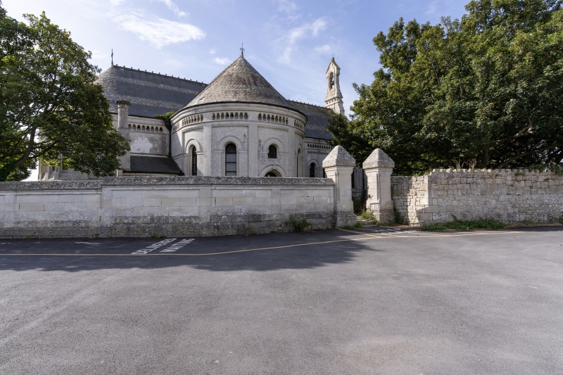
Entry Name: Gate Piers and Boundary Walls to North and West of St Peter's Church
Listing Date: 21 September 1978
Last Amended: 17 May 1993
Grade: II
Source: Historic England
Source ID: 1205794
English Heritage Legacy ID: 381977
ID on this website: 101205794
Location: St Peter's Church, Grove, Dorset, DT5
County: Dorset
Civil Parish: Portland
Built-Up Area: Grove
Traditional County: Dorset
Lieutenancy Area (Ceremonial County): Dorset
Church of England Parish: Portland All Saints
Church of England Diocese: Salisbury
Tagged with: Gatepost
PORTLAND
SY67SE INCLINE ROAD, Grove 969-1/1/195 Gate Piers and Boundary Walls to N 21/09/78 and W of St. Peter's Church (Formerly Listed as: INCLINE ROAD Gate Piers to Grove Road Street wall on S and E sides of Incline Road from Grov)
GV II
Gate piers and boundary walls. c 1875. Portland ashlar. Pair of piers to c 3.5m height. Large square piers to moulded plinth and with heavy pyramidal capping on a moulded pier head; the corners of the piers have small inset collonnettes. To the left a series of stepped panels, rising to a saddle-backed coping on roll-mould, and plinth continuous with piers. The wall with panels also continues to the W behind the boundary wall to the Vicarage to link with the main boundary wall on Grove Road. These walls are part of a series of significant elements, helping to tie together the group of related buildings, and defining the spaces.
Listing NGR: SY6985172593
External links are from the relevant listing authority and, where applicable, Wikidata. Wikidata IDs may be related buildings as well as this specific building. If you want to add or update a link, you will need to do so by editing the Wikidata entry.


Other nearby listed buildings