Latitude: 50.5521 / 50°33'7"N
Longitude: -2.426 / 2°25'33"W
OS Eastings: 369913
OS Northings: 72572
OS Grid: SY699725
Mapcode National: GBR PZ.3BY0
Mapcode Global: FRA 57TL.SSX
Plus Code: 9C2VHH2F+VH
Entry Name: Boundary Wall and Gate Piers from Vicarage to Alma Terrace
Listing Date: 21 September 1978
Grade: II
Source: Historic England
Source ID: 1203094
English Heritage Legacy ID: 381961
ID on this website: 101203094
Location: St Peter's Church, Grove, Dorset, DT5
County: Dorset
Civil Parish: Portland
Built-Up Area: Grove
Traditional County: Dorset
Lieutenancy Area (Ceremonial County): Dorset
Church of England Parish: Portland All Saints
Church of England Diocese: Salisbury
Tagged with: Wall
PORTLAND
SY67SE GROVE ROAD, Grove 969-1/1/140 (North East side) 21/09/78 Boundary wall and gate piers from Vicarage to Alma Terrace
GV II
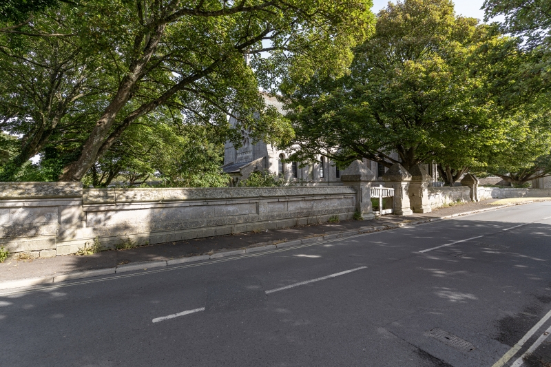
Boundary wall and gate piers. c 1875. Portland ashlar. Eight sets of gate piers with linking walls, from west end of St. Peter's churchyard to the return to front of Alma Terrace (qv). Large square piers set to moulded plinth and with heavy pyramidal capping on moulded pier head. Corners of piers with small inset colonettes. Piers are linked between gateways by series of stepped panels of wall, rising to c 1.4m; saddle-back coping with roll mould over series of sunk panels, and plinth continuous with gate piers. At the S end the wall returns at right angles to the face of No 1, Alma Terrace. At the west end the wall returns as boundary between the churchyard and the Vicarage (qv), then along the north side of the churchyard, including further pair of matching gate piers opposite north transept of church, returning again along SE boundary of churchyard. A boundary stone is built into the wall at its W end, facing Grove Road. It bears the WD arrow above an anchor and the number 70. Very substantial elements, playing a significant part in tying together this group of related buildings, and in defining the street. They also link with the wall defining the north side of Grove Road, further west, and with the lofty wall to HM Young Offenders Institution to the S (qv).
Listing NGR: SY6991372572
External links are from the relevant listing authority and, where applicable, Wikidata. Wikidata IDs may be related buildings as well as this specific building. If you want to add or update a link, you will need to do so by editing the Wikidata entry.


Other nearby listed buildings