Latitude: 50.5597 / 50°33'34"N
Longitude: -2.4343 / 2°26'3"W
OS Eastings: 369333
OS Northings: 73418
OS Grid: SY693734
Mapcode National: GBR PZ.2W55
Mapcode Global: FRA 57SL.9GL
Plus Code: 9C2VHH58+V7
Entry Name: The Citadel, South Entrance
Listing Date: 17 May 1993
Grade: II*
Source: Historic England
Source ID: 1203116
English Heritage Legacy ID: 382027
ID on this website: 101203116
Location: Fortuneswell, Dorset, DT5
County: Dorset
Civil Parish: Portland
Traditional County: Dorset
Lieutenancy Area (Ceremonial County): Dorset
Church of England Parish: Portland All Saints
Church of England Diocese: Salisbury
Tagged with: Architectural structure
PORTLAND
SY6873 THE CITADEL, The Verne 969-1/3/173 (North side) The Citadel, South Entrance
GV II*
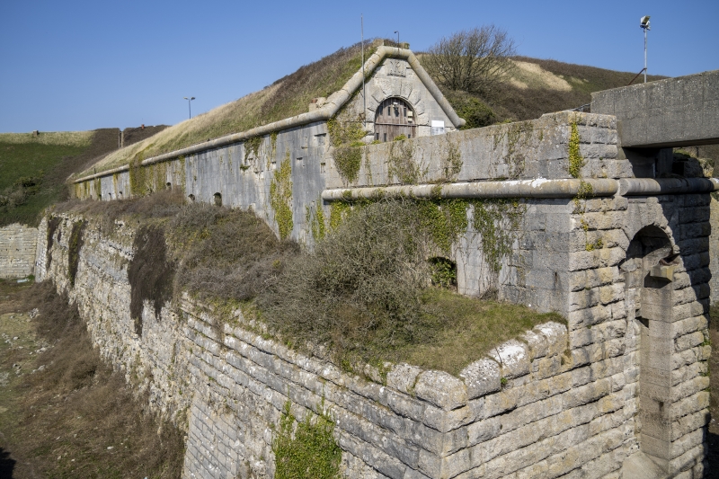
Gatehouse to citadel, now prison. Dated 1881, possibly from office of Capt. E Crossman RE, general designer of The Citadel.Portland ashlar. Long narrow entrance corridor has at S end a round arch over main plank doors, with heavy rusticated quoins and voussoirs beneath carved panel with VR 1881 to heavy roll-moulded gable and flat parapet top. Arch approached over C20 concrete bridge to large landing on very deep substructure; this has heavy rock-faced masonry to S with deep and lofty blind arch, returning left to plain wall and parapet above heavy roll mould which continuies on three sides at this level. Right return has plain walling with various slits and openings dropping into deep ditch. The left return of the main building continues c 100m in plain ashlar to roll-mould top, with various segmental-headed openings. The whole is roofed in turf, and runs back to the SW casemates (qv). Very dramatically set above the S and SE Ditches.
Listing NGR: SY6933373418
External links are from the relevant listing authority and, where applicable, Wikidata. Wikidata IDs may be related buildings as well as this specific building. If you want to add or update a link, you will need to do so by editing the Wikidata entry.


Other nearby listed buildings