Latitude: 50.5589 / 50°33'32"N
Longitude: -2.4358 / 2°26'8"W
OS Eastings: 369225
OS Northings: 73328
OS Grid: SY692733
Mapcode National: GBR PZ.2VNZ
Mapcode Global: FRA 57SL.8W0
Plus Code: 9C2VHH57+HM
Entry Name: Bridge at Sy 6923 7333
Listing Date: 21 September 1978
Last Amended: 17 May 1993
Grade: II
Source: Historic England
Source ID: 1206274
English Heritage Legacy ID: 382047
ID on this website: 101206274
Location: Fortuneswell, Dorset, DT5
County: Dorset
Civil Parish: Portland
Built-Up Area: Fortuneswell
Traditional County: Dorset
Lieutenancy Area (Ceremonial County): Dorset
Church of England Parish: Portland All Saints
Church of England Diocese: Salisbury
Tagged with: Bridge
PORTLAND
SY6873 VERNE ROAD, Yeates 969-1/3/190 Bridge at SY 6923 7333 21/09/78 (Formerly Listed as: VERNE ROAD FOUR BRIDGES OVER FORMER MERCHANT'S TRAMWAY SW OF THE VERNE'S S ENTRANCE)
GV II
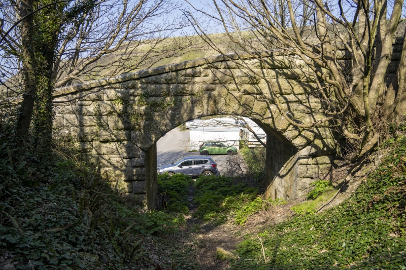
Road bridge over mineral railway. Dated 1875. Heavy rock-faced squared stone. Single segmental arch with rusticated quoins and voussoirs on plain internal abutments; probably with plinth, but lower parts concealed by raised ground level. Heavy square-edged weathered parapet, which is set at incline following road slope, with a change in the angle of incline above the arch centre; length c 15m. The earliest of three bridges in alignment over the former tramway. Dated 1875 on the road side of the N parapet. Of interest as it is a reminder of the C19 industrial activity in the quarries on the island, when rail and tramways were an important aspect of the transport system.
Listing NGR: SY6922573328
External links are from the relevant listing authority and, where applicable, Wikidata. Wikidata IDs may be related buildings as well as this specific building. If you want to add or update a link, you will need to do so by editing the Wikidata entry.


Other nearby listed buildings