Approximate Location Map
Large Map »
Latitude: 51.374 / 51°22'26"N
Longitude: 1.3094 / 1°18'33"E
OS Eastings: 630422
OS Northings: 169078
OS Grid: TR304690
Mapcode National: GBR WZW.V59
Mapcode Global: VHLG5.NQ2L
Plus Code: 9F3398F5+HQ
Entry Name: 197, Canterbury Road
Listing Date: 22 February 1976
Grade: II
Source: Historic England
Source ID: 1203303
English Heritage Legacy ID: 356491
ID on this website: 101203303
Location: Birchington, Thanet, Kent, CT7
County: Kent
District: Thanet
Civil Parish: Birchington
Built-Up Area: Margate
Traditional County: Kent
Lieutenancy Area (Ceremonial County): Kent
Tagged with: Building
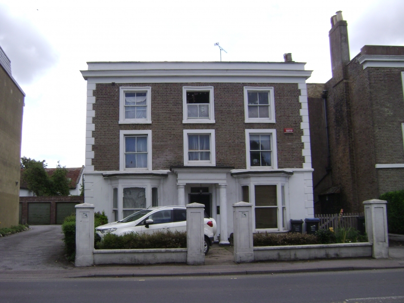
CANTERBURY ROAD
1.
1380
(South Side)
BIRCHINGTON-ON-SEA
No 197
TR 36 NW 9/110
II
2.
Mid C19. 3 storeys brown brick with stuccoed quoins and base. Dropped moulded
eaves cornice. 3 sashes with verticals only set in moulded architraves. The
ground floor has 2 2-light canted bays. Portico with 2 plain Tuscan columns
and 2 pilasters, rectangular fanlight. 2 stone lions.
Listing NGR: TR3042269078
External links are from the relevant listing authority and, where applicable, Wikidata. Wikidata IDs may be related buildings as well as this specific building. If you want to add or update a link, you will need to do so by editing the Wikidata entry.


Other nearby listed buildings
