Approximate Location Map
Large Map »
Latitude: 51.3741 / 51°22'26"N
Longitude: 1.3081 / 1°18'28"E
OS Eastings: 630327
OS Northings: 169090
OS Grid: TR303690
Mapcode National: GBR WZW.TSL
Mapcode Global: VHLG5.MQCG
Plus Code: 9F3398F5+J6
Entry Name: Smugglers' Cafe
Listing Date: 10 April 1951
Grade: II
Source: Historic England
Source ID: 1203373
English Heritage Legacy ID: 356498
ID on this website: 101203373
Location: Birchington, Thanet, Kent, CT7
County: Kent
District: Thanet
Civil Parish: Birchington
Built-Up Area: Margate
Traditional County: Kent
Lieutenancy Area (Ceremonial County): Kent
Tagged with: Architectural structure
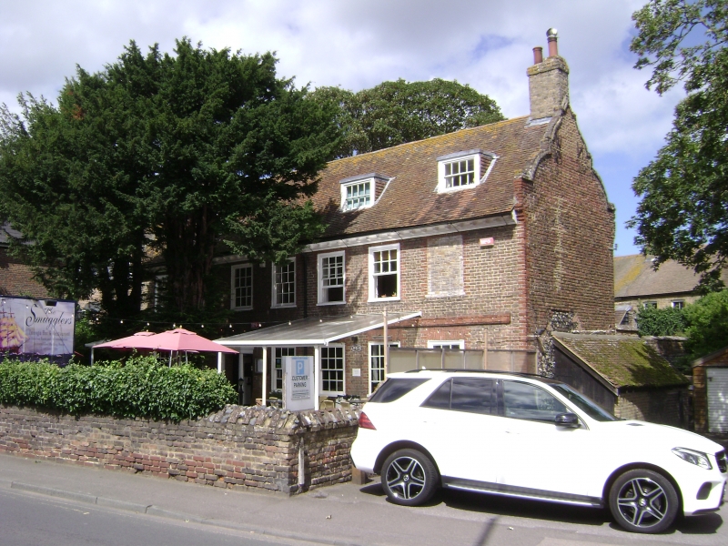
CANTERBURY ROAD
1.
1380
(North Side)
BIRCHINGTON-ON-SEA
No 212
(Smugglers' Cafe)
TR 36 NW 9/83 10.4.51
II
2.
C18. 2 storeys and attic brown brick with red brick dressings, quoins and
stringcourse. Roof has shaped Dutch gables at the ends and wooden modillion
eaves cornice. 3 dormers. 6 windows and 1 blocked window space with glazing
bars intact. Doorcase with heavy flat hood over supported on brackets.
Listing NGR: TR3032769090
External links are from the relevant listing authority and, where applicable, Wikidata. Wikidata IDs may be related buildings as well as this specific building. If you want to add or update a link, you will need to do so by editing the Wikidata entry.


Other nearby listed buildings
