Latitude: 51.4812 / 51°28'52"N
Longitude: -2.5552 / 2°33'18"W
OS Eastings: 361539
OS Northings: 175950
OS Grid: ST615759
Mapcode National: GBR CJ7.ZW
Mapcode Global: VH88N.N1JB
Plus Code: 9C3VFCJV+FW
Entry Name: Colston School, the Lodge
Listing Date: 30 December 1994
Grade: II
Source: Historic England
Source ID: 1204076
English Heritage Legacy ID: 378943
ID on this website: 101204076
Location: Stapleton, Bristol, BS16
County: City of Bristol
Electoral Ward/Division: Eastville
Parish: Non Civil Parish
Built-Up Area: Bristol
Traditional County: Gloucestershire
Lieutenancy Area (Ceremonial County): Bristol
Church of England Parish: Stapleton
Church of England Diocese: Bristol
Tagged with: Gatehouse
BRISTOL
ST6175 BELL HILL, Stapleton 901-1/33/1940 (South side) Colston School, The Lodge
GV II
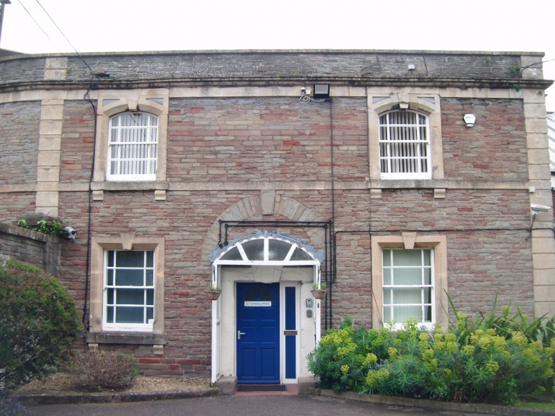
House. Mid C19. Coursed, squared Pennant rubble with limestone dressings and pantile roof. Double-depth plan. 2 storeys; 2-window range. Symmetrical front with a plat band and rusticated quoin strips; central round-headed, keyed relieving arch with ashlar voussoirs above a plain doorway with a large key, and C20 porch. Flat-headed windows with chamfered, keyed architraves and brackets, with sashes; similar openings on the second floor, but with segmental heads, and sunken spandrels above. The left-hand return curves back, outside the entrance gates. INTERIOR not inspected. The lodge is part of the entrance to Colston's School (qv).
Listing NGR: ST6153975950
External links are from the relevant listing authority and, where applicable, Wikidata. Wikidata IDs may be related buildings as well as this specific building. If you want to add or update a link, you will need to do so by editing the Wikidata entry.


Other nearby listed buildings