Latitude: 52.1934 / 52°11'36"N
Longitude: -1.7072 / 1°42'26"W
OS Eastings: 420109
OS Northings: 255057
OS Grid: SP201550
Mapcode National: GBR 4LT.F5W
Mapcode Global: VHBY0.C49C
Plus Code: 9C4W57VV+94
Entry Name: 8 and 9, Henley Street
Listing Date: 4 April 1994
Grade: II
Source: Historic England
Source ID: 1205394
English Heritage Legacy ID: 366266
ID on this website: 101205394
Location: Stratford-upon-Avon, Stratford-on-Avon, Warwickshire, CV37
County: Warwickshire
District: Stratford-on-Avon
Civil Parish: Stratford-upon-Avon
Built-Up Area: Stratford-upon-Avon
Traditional County: Warwickshire
Lieutenancy Area (Ceremonial County): Warwickshire
Church of England Parish: Stratford on Avon Holy Trinity
Church of England Diocese: Coventry
Tagged with: Building
STRATFORD-UPON-AVON
SP2055SW HENLEY STREET 604-1/8/101 (North East side) Nos.8 AND 9
GV II
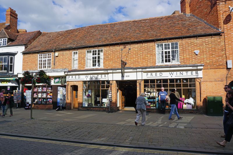
Two houses, now shops. 1770s. Brick with buff headers; tile roof with brick end stack. 2 storeys; 3-window range. Platt band over ground floor and top modillioned brick cornice. C20 shop fronts flank entrance, with exposed platt band to right end; 1st floor has 3 large windows with 3-light transom small-paned casements with iron opening lights; narrow inserted window to left of centre. C20 rear additions. Included for group value. (Bearman R: Stratford-upon-Avon: A History of its Streets and Buildings: Nelson: 1988-: 37).
Listing NGR: SP2010955057
External links are from the relevant listing authority and, where applicable, Wikidata. Wikidata IDs may be related buildings as well as this specific building. If you want to add or update a link, you will need to do so by editing the Wikidata entry.


Other nearby listed buildings