Approximate Location Map
Large Map »
Latitude: 50.5306 / 50°31'50"N
Longitude: -3.772 / 3°46'19"W
OS Eastings: 274506
OS Northings: 71592
OS Grid: SX745715
Mapcode National: GBR QG.TW6C
Mapcode Global: FRA 27ZN.J9M
Plus Code: 9C2RG6JH+66
Entry Name: Engine House and Chimney at Druid Copper Mine
Listing Date: 10 May 1973
Last Amended: 1 September 1992
Grade: II
Source: Historic England
Source ID: 1206269
English Heritage Legacy ID: 375978
ID on this website: 101206269
Location: Teignbridge, Devon, TQ13
County: Devon
District: Teignbridge
Civil Parish: Ashburton
Traditional County: Devon
Lieutenancy Area (Ceremonial County): Devon
Church of England Parish: Ashburton St Andrew
Church of England Diocese: Exeter
Tagged with: Copper mine
ASHBURTON
SX77SW DRUID
849-1/1/232 Engine House and chimney at Druid
10/05/73 Copper Mine
(Formerly Listed as:
DRUID
Druid's Mine, Chimney and Engine
house)
II
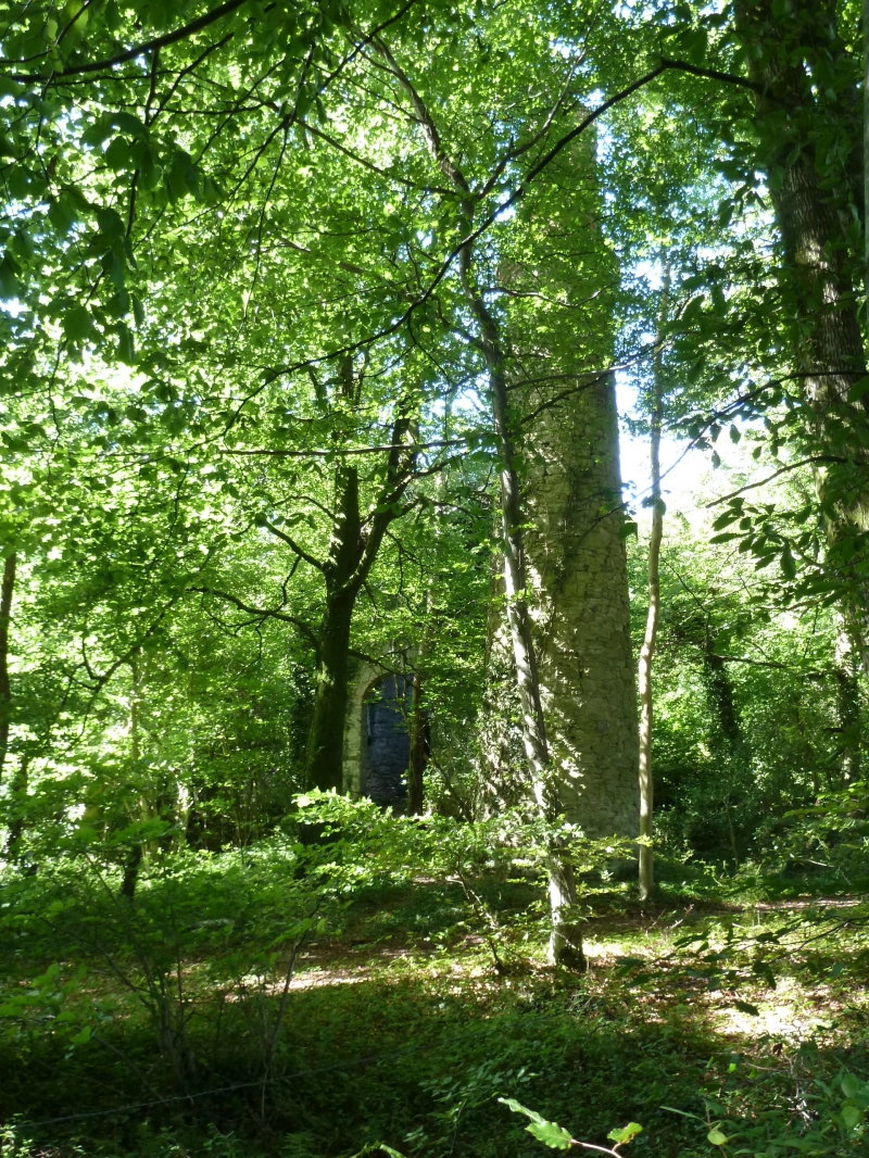
Ruined engine house and chimney. Probably mid C19. Stone
rubble; chimney has a red-brick top. Engine-house roof
removed. Engine-house consists of a single chamber, roughly
square in plan. About 8.5m to E is the circular chimney. The
mineshaft lies immediately W of the engine-house and to the N
of this is a series of below-ground chambers. The engine-house
is a tall building, probably 2-storeyed and with an
underground chamber originally. Most of the walls survive,
although some masonry has collapsed at the top. The E side has
a tall round-arched doorway and there are similar, smaller
openings on the S and W sides. The S side seems to have been
decorated with pilaster-strips. On the N side is a tall narrow
opening, presumably for a piece of machinery. The chimney is
almost complete. At the top of the stone shaft is a cornice
composed of projecting brick courses, and above that a short
brick shaft with round-arched panels on its sides. The owner
says the mine ceased working in 1888.
(Harris H: Industrial Archaeology of Dartmoor: Newton Abbot:
1972-: 185; 1990-: G E WINDEATT LETTER).
Listing NGR: SX7450671592
External links are from the relevant listing authority and, where applicable, Wikidata. Wikidata IDs may be related buildings as well as this specific building. If you want to add or update a link, you will need to do so by editing the Wikidata entry.


Other nearby listed buildings
