Latitude: 51.4915 / 51°29'29"N
Longitude: -2.6793 / 2°40'45"W
OS Eastings: 352934
OS Northings: 177170
OS Grid: ST529771
Mapcode National: GBR JM.K6RF
Mapcode Global: VH88D.HRXZ
Plus Code: 9C3VF8RC+J7
Entry Name: The Wylands, British Telecom Training Centre
Listing Date: 4 March 1977
Last Amended: 30 December 1994
Grade: II
Source: Historic England
Source ID: 1206419
English Heritage Legacy ID: 379960
ID on this website: 101206419
Location: Shirehampton, Bristol, BS11
County: City of Bristol
Electoral Ward/Division: Avonmouth and Lawrence Weston
Parish: Non Civil Parish
Built-Up Area: Bristol
Traditional County: Gloucestershire
Lieutenancy Area (Ceremonial County): Bristol
Church of England Parish: Shirehampton
Church of England Diocese: Bristol
Tagged with: Architectural structure
BRISTOL
ST57NW LOWER HIGH STREET, Shirehampton 901-1/52/1750 (West side) 04/03/77 The Wylands, British Telecom Training Centre (Formerly Listed as: LOWER HIGH STREET (North side) Post Office Regional School, south-west District (The Wylands))
II
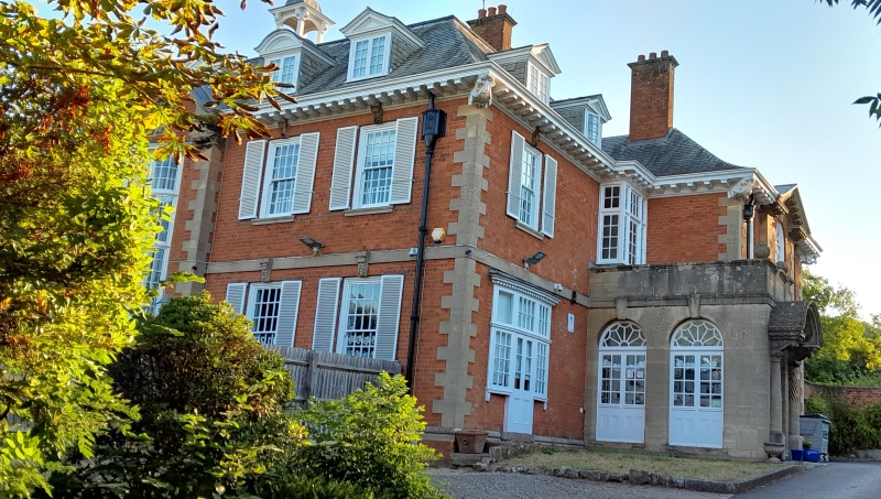
House, now training centre. 1905. By F Bligh Bond. Brick with limestone dressings, brick ridge stacks and Cornish slate hipped roof. Double-depth plan. Edwardian Baroque style. 2 storeys and attic; 5-window range. A symmetrical front has quoins and a projecting centre, with a swan's-neck segmental pediment on scrolled corbels and an oculus under a swagged panel, and a 2-storey fully-glazed oriel stair light; windows have rubbed brick flat-arches with grotesque keys to 12/12-pane sashes, with ground-floor plat band and shutters; deep, sprocketed eaves have brackets and swagged, scrolled corner brackets, 5 dormers have alternate triangular and segmental pediments and casement windows, and an open square cupola. The right-hand elevation has a projecting single-storey parapeted porch: Ionic columns with barleysugar fluting to a bracketed segmental canopy, coffered underneath, and a semicircular-arched doorway with a timber fanlight and 6-panel door; a semicircular-arched 2-light arcade to the left side. To the right is a symmetrical elevation with a pedimented centre stepped forward, a 12/12-pane ground-floor sash window flanked by oculi, and a semicircular-arched central first-floor window. INTERIOR: central hall with arched openings and oval ceiling panel, and a dogleg stair with square, moulded balusters and newels. (Gomme A, Jenner M and Little B: Bristol, An Architectural History: Bristol: 1979-: 400).
Listing NGR: ST5293477170
External links are from the relevant listing authority and, where applicable, Wikidata. Wikidata IDs may be related buildings as well as this specific building. If you want to add or update a link, you will need to do so by editing the Wikidata entry.


Other nearby listed buildings