Latitude: 51.49 / 51°29'23"N
Longitude: -2.6792 / 2°40'45"W
OS Eastings: 352937
OS Northings: 177000
OS Grid: ST529770
Mapcode National: GBR JM.K6RZ
Mapcode Global: VH88D.HTY4
Plus Code: 9C3VF8QC+X8
Entry Name: The Priory
Listing Date: 8 January 1959
Last Amended: 30 December 1994
Grade: II
Source: Historic England
Source ID: 1217807
English Heritage Legacy ID: 380231
ID on this website: 101217807
Location: Shirehampton, Bristol, BS11
County: City of Bristol
Electoral Ward/Division: Avonmouth and Lawrence Weston
Parish: Non Civil Parish
Built-Up Area: Bristol
Traditional County: Gloucestershire
Lieutenancy Area (Ceremonial County): Bristol
Church of England Parish: Shirehampton
Church of England Diocese: Bristol
Tagged with: Priory
BRISTOL
ST57NW PRIORY GARDENS, Shirehampton 901-1/52/1759 (West side) 08/01/59 The Priory (Formerly Listed as: HIGH STREET, Shirehampton The Priory)
II
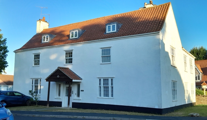
Domestic building, said to be associated with medieval priory, now flats. Reported to be C15, altered C16, C17 and C18, remodelled c1980. Render over timber frame, with gable stacks and sprocketed pantile roof. L-shaped double-depth plan. A symmetrical Georgian-style front has C20 porch to late C18 half-glazed door and rectangular overlight with round glazing bars and 2 narrow windows with margin bars; late C20 tripartite ground-floor windows and 8/8-pane first-floor windows, and casement dormers. INTERIOR not inspected; said to have fine hall roof, arch-braced with cusped wind-braces in 3 tiers. No documentary evidence to support its connection with any monastery buildings. The introduction of a hard, patterned render and late C20 fenestration has destroyed the historic surface texture of the building, and much of its character.
Listing NGR: ST5293777000
External links are from the relevant listing authority and, where applicable, Wikidata. Wikidata IDs may be related buildings as well as this specific building. If you want to add or update a link, you will need to do so by editing the Wikidata entry.


Other nearby listed buildings