Latitude: 54.9217 / 54°55'17"N
Longitude: -1.3974 / 1°23'50"W
OS Eastings: 438720
OS Northings: 558717
OS Grid: NZ387587
Mapcode National: GBR V9C.8N
Mapcode Global: WHD55.HKSB
Plus Code: 9C6WWJC3+M2
Entry Name: 76-92, James Armitage Street
Listing Date: 10 November 1978
Last Amended: 17 October 1994
Grade: II
Source: Historic England
Source ID: 1207100
English Heritage Legacy ID: 391504
ID on this website: 101207100
Location: Southwick, Sunderland, Tyne and Wear, SR5
County: Sunderland
Electoral Ward/Division: Southwick
Parish: Non Civil Parish
Built-Up Area: Sunderland
Traditional County: Durham
Lieutenancy Area (Ceremonial County): Tyne and Wear
Church of England Parish: North Wearside
Church of England Diocese: Durham
Tagged with: Building
SUNDERLAND
NZ3858 JAMES ARMITAGE STREET, Southwick 920-1/8/288 (West side) 10/11/78 Nos.76-92 (Even) (Formerly Listed as: JAMES ARMITAGE STREET (East side) Nos.74-92 (Even))
GV II
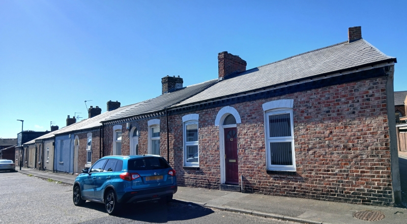
Row of 9 cottages. c1870. Originally brick, Nos 80, 82 and 84 now pebble-dash rendered, with painted ashlar dressings and Welsh slate roofs. One storey, one window except Nos 90 and 92, 2 windows. Round brick arches over renewed doors and overlights paired between single window houses and central in others. Segment headed gauged brick flat arches over renewed windows with projecting stone sills. Brick eaves gutter brackets and moulded brick cornice. Low pitched roof has transverse ridge chimneys. Of sociological as well as architectural interest as examples of the single-storey cottage which was the preferred working class housing type in C19 Sunderland.
Listing NGR: NZ3872058716
External links are from the relevant listing authority and, where applicable, Wikidata. Wikidata IDs may be related buildings as well as this specific building. If you want to add or update a link, you will need to do so by editing the Wikidata entry.


Other nearby listed buildings