Latitude: 54.895 / 54°53'42"N
Longitude: -1.3801 / 1°22'48"W
OS Eastings: 439858
OS Northings: 555765
OS Grid: NZ398557
Mapcode National: GBR VCZ.03
Mapcode Global: WHD5C.S707
Plus Code: 9C6WVJW9+2X
Entry Name: Terrace Walls and Piers to Ashburne House
Listing Date: 17 October 1994
Grade: II
Source: Historic England
Source ID: 1207122
English Heritage Legacy ID: 391564
ID on this website: 101207122
Location: Humbledon View, Sunderland, Tyne and Wear, SR2
County: Sunderland
Electoral Ward/Division: St Michael's
Parish: Non Civil Parish
Built-Up Area: Sunderland
Traditional County: Durham
Lieutenancy Area (Ceremonial County): Tyne and Wear
Church of England Parish: Bishopwearmouth St Nicholas
Church of England Diocese: Durham
Tagged with: Wall
SUNDERLAND
NZ3955 RYHOPE ROAD 920-1/16/186 (West side (off)) Terrace walls and piers to Ashburne House
GV II
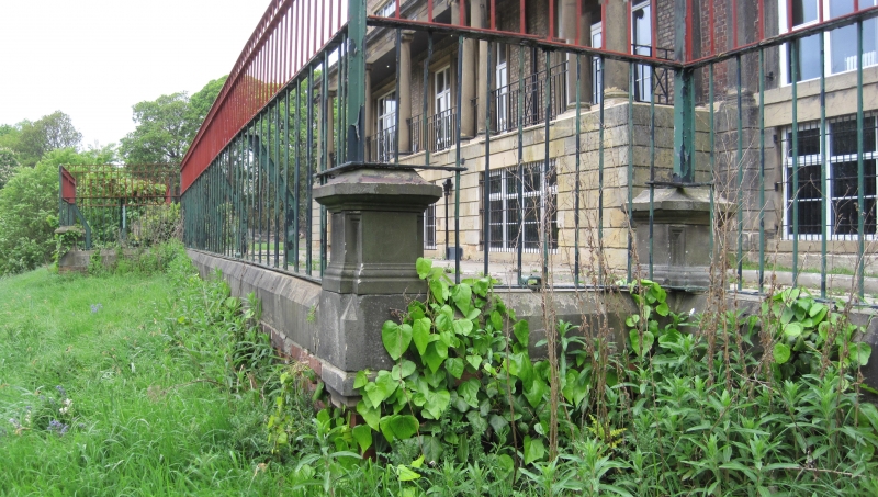
Terrace walls and piers to Ashburne House (qv). Probably c1860 for Backhouse family. Ashlar. Low walls with chamfered coping enclose terrace to S of Ashburne House, beginning at steps on W which lead to former grounds, now Backhouse Park (a public park), continuing along S wall of terrace and returning along E as far as steps to Ryhope Road. At centre of S the terrace projects to form a platform overlooking the grounds. At each angle of the wall there is a panelled square pier with plinth and cornice.
Listing NGR: NZ3985855764
External links are from the relevant listing authority and, where applicable, Wikidata. Wikidata IDs may be related buildings as well as this specific building. If you want to add or update a link, you will need to do so by editing the Wikidata entry.


Other nearby listed buildings