Latitude: 53.7643 / 53°45'51"N
Longitude: -2.7037 / 2°42'13"W
OS Eastings: 353705
OS Northings: 430002
OS Grid: SD537300
Mapcode National: GBR T98.MG
Mapcode Global: WH85M.FNQ2
Plus Code: 9C5VQ77W+PG
Entry Name: Windmill
Listing Date: 12 June 1950
Grade: II
Source: Historic England
Source ID: 1207265
English Heritage Legacy ID: 391968
ID on this website: 101207265
Location: Adelphi, Preston, Lancashire, PR1
County: Lancashire
District: Preston
Electoral Ward/Division: St George's
Parish: Non Civil Parish
Built-Up Area: Preston
Traditional County: Lancashire
Lieutenancy Area (Ceremonial County): Lancashire
Church of England Parish: Preston All Saints
Church of England Diocese: Blackburn
Tagged with: Windmill
PRESTON
SD5329NE CRAGGS ROW 941-1/9/88 (East side) 12/06/50 Windmill
II
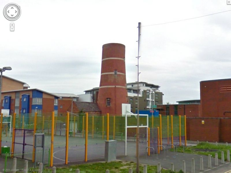
Tower of former windmill. Probably early C19; altered. Red brick (now mostly rendered and painted red with 3 white bands). Circular plan. Six stages, tapering and waisted slightly (bottle-shaped); 3-stage rectangular loading slot projected on south-west side, and 3 small square windows vertically aligned above this; some other windows towards rear. Flat modern cap replacing missing superstructure. Only surviving example in the town, and one of the few survivors in the county.
Listing NGR: SD5370530002
External links are from the relevant listing authority and, where applicable, Wikidata. Wikidata IDs may be related buildings as well as this specific building. If you want to add or update a link, you will need to do so by editing the Wikidata entry.


Other nearby listed buildings