Latitude: 54.0508 / 54°3'2"N
Longitude: -1.6714 / 1°40'16"W
OS Eastings: 421613
OS Northings: 461701
OS Grid: SE216617
Mapcode National: GBR JPRL.YN
Mapcode Global: WHC85.9FCX
Plus Code: 9C6W382H+8F
Entry Name: Church of St Jude
Listing Date: 3 March 1987
Grade: II
Source: Historic England
Source ID: 1207629
English Heritage Legacy ID: 331237
Also known as: St Jude, Hartwith cum Winsley
St Jude's Church, Hartwith
ID on this website: 101207629
Location: St Jude's Church, Hartwith, North Yorkshire, HG3
County: North Yorkshire
District: Harrogate
Civil Parish: Hartwith cum Winsley
Traditional County: Yorkshire
Lieutenancy Area (Ceremonial County): North Yorkshire
Tagged with: Church building
HARTWITH-CUM-WINSLEY CHAPEL LANE SE 26 SW (west side) Hartwith 9/107 Church of St Jude
GV II
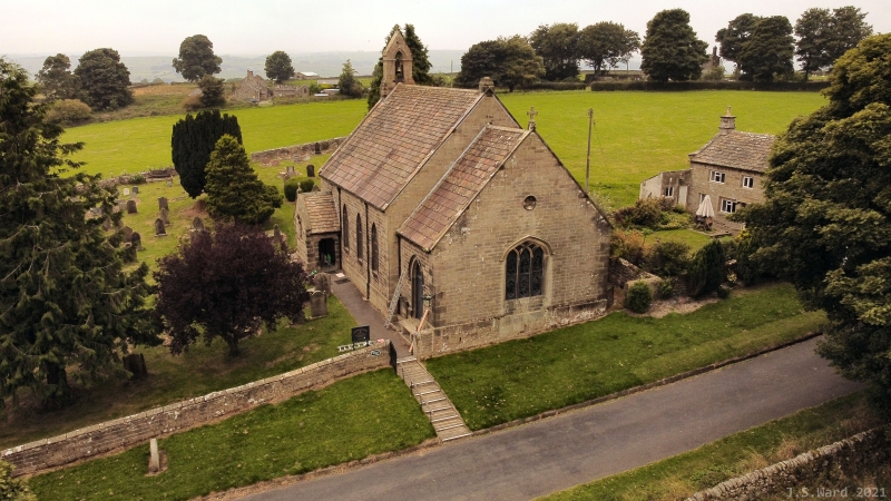
Church. 1751, enlarged 1830. Coursed squared gritstone, graduated stone slate roof. 4-bay nave with added south porch and l-bay chancel. 3 pointed-arched windows to nave and doorway to chancel; added porch and chancel have hoodmoulds. Shaped kneelers, gable copings and stone bellcote west end of nave. Interior: refurbished 1878. The church was built by subscription of landowners and tenants as a detached chapelry of the parish of Kirkby Malzard. The east end was added in 1830, including a vestry and sextons room. In 1878 the building was 'rendered suitable for divine service' including the construction of a chancel arch and 1891 it was rededicated to St Jude. W Grainge, Nidderdale, 1893, p 96.
Listing NGR: SE2161361701
External links are from the relevant listing authority and, where applicable, Wikidata. Wikidata IDs may be related buildings as well as this specific building. If you want to add or update a link, you will need to do so by editing the Wikidata entry.


Other nearby listed buildings