Latitude: 52.6324 / 52°37'56"N
Longitude: -1.6977 / 1°41'51"W
OS Eastings: 420559
OS Northings: 303890
OS Grid: SK205038
Mapcode National: GBR 4FD.X7G
Mapcode Global: WHCH3.W3R8
Plus Code: 9C4WJ8J2+XW
Entry Name: Holloway Lodge
Listing Date: 11 May 1950
Grade: II
Source: Historic England
Source ID: 1208309
English Heritage Legacy ID: 386503
ID on this website: 101208309
Location: Tamworth, Staffordshire, B79
County: Staffordshire
District: Tamworth
Electoral Ward/Division: Castle
Parish: Non Civil Parish
Built-Up Area: Bitterscote
Traditional County: Warwickshire
Lieutenancy Area (Ceremonial County): Staffordshire
Church of England Parish: Tamworth St Editha
Church of England Diocese: Lichfield
Tagged with: Gatehouse
TAMWORTH
SK2003NE HOLLOWAY 670-1/9/78 (East side) 11/05/50 Holloway Lodge
GV II
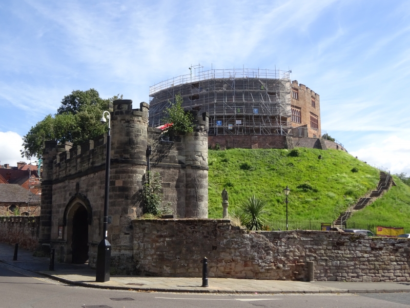
Lodge. Dated 1810. Ashlar with hipped slate roof. In form of castle gatehouse. Gothic Revival style. Round angle turrets on battered bases, 2 platt bands and embattled parapet. Central carriage entrance with 4-centred head, hood with iron horseshoe stops and paired studded doors, Ferrers arms above; flanking blind slots. Rear has similar entrance with Townshend arms above; flanking 2-light double-hollow-chamfered-mullioned windows, with 3 similar windows to 1st floor. Returns of carriageway have entrances with 4-centred heads and 6-flush-panel doors.
Listing NGR: SK2055903890
External links are from the relevant listing authority and, where applicable, Wikidata. Wikidata IDs may be related buildings as well as this specific building. If you want to add or update a link, you will need to do so by editing the Wikidata entry.


Other nearby listed buildings