Latitude: 52.6327 / 52°37'57"N
Longitude: -1.6979 / 1°41'52"W
OS Eastings: 420544
OS Northings: 303926
OS Grid: SK205039
Mapcode National: GBR 4FD.X4R
Mapcode Global: WHCH3.W3N1
Plus Code: 9C4WJ8M2+3R
Entry Name: 3 and 4, Lady Bank
Listing Date: 9 November 1972
Last Amended: 28 February 1992
Grade: II
Source: Historic England
Source ID: 1208400
English Heritage Legacy ID: 386516
ID on this website: 101208400
Location: Tamworth, Staffordshire, B79
County: Staffordshire
District: Tamworth
Electoral Ward/Division: Castle
Parish: Non Civil Parish
Built-Up Area: Bitterscote
Traditional County: Staffordshire
Lieutenancy Area (Ceremonial County): Staffordshire
Church of England Parish: Tamworth St Editha
Church of England Diocese: Lichfield
Tagged with: Building
TAMWORTH
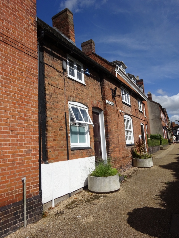
SK2003NE LADY BANK 670-1/9/91 (West side) 09/11/72 Nos.3 AND 4 (Formerly Listed as: HOLLOW WAY Nos.3 AND 4)
GV II
Two houses, now office. Late C16 or early C17 with early to mid C19 remodelling. Timber frame with brick cladding; tile roof with brick stacks. 2-unit plan. 2 storeys; 3-window range. 2 segmental-headed entrances have C20 glazed doors. 2 segmental-headed windows to ground floor have 4-pane and 20-pane horned sashes; 1st floor windows have casements with pegged frames. Exposed wall post and wall plate to left end. 2 brick stacks forward of ridge. Right return has exposed collar and tie beam truss with queen struts. Rear has 2 gabled wings; lateral and end stacks. Interior: exposed timber framing and chamfered beams.
Listing NGR: SK2054403926
External links are from the relevant listing authority and, where applicable, Wikidata. Wikidata IDs may be related buildings as well as this specific building. If you want to add or update a link, you will need to do so by editing the Wikidata entry.


Other nearby listed buildings