Approximate Location Map
Large Map »
Latitude: 52.6344 / 52°38'3"N
Longitude: -2.4517 / 2°27'6"W
OS Eastings: 369524
OS Northings: 304172
OS Grid: SJ695041
Mapcode National: GBR BX.753X
Mapcode Global: WH9DH.91RP
Plus Code: 9C4VJGMX+Q8
Entry Name: 7, Church Street
Listing Date: 8 April 1983
Grade: II
Source: Historic England
Source ID: 1208689
English Heritage Legacy ID: 362327
ID on this website: 101208689
Location: Madeley, Telford and Wrekin, Shropshire, TF7
County: Telford and Wrekin
Civil Parish: Madeley
Built-Up Area: Telford
Traditional County: Shropshire
Lieutenancy Area (Ceremonial County): Shropshire
Church of England Parish: Madeley
Church of England Diocese: Hereford
Tagged with: Building
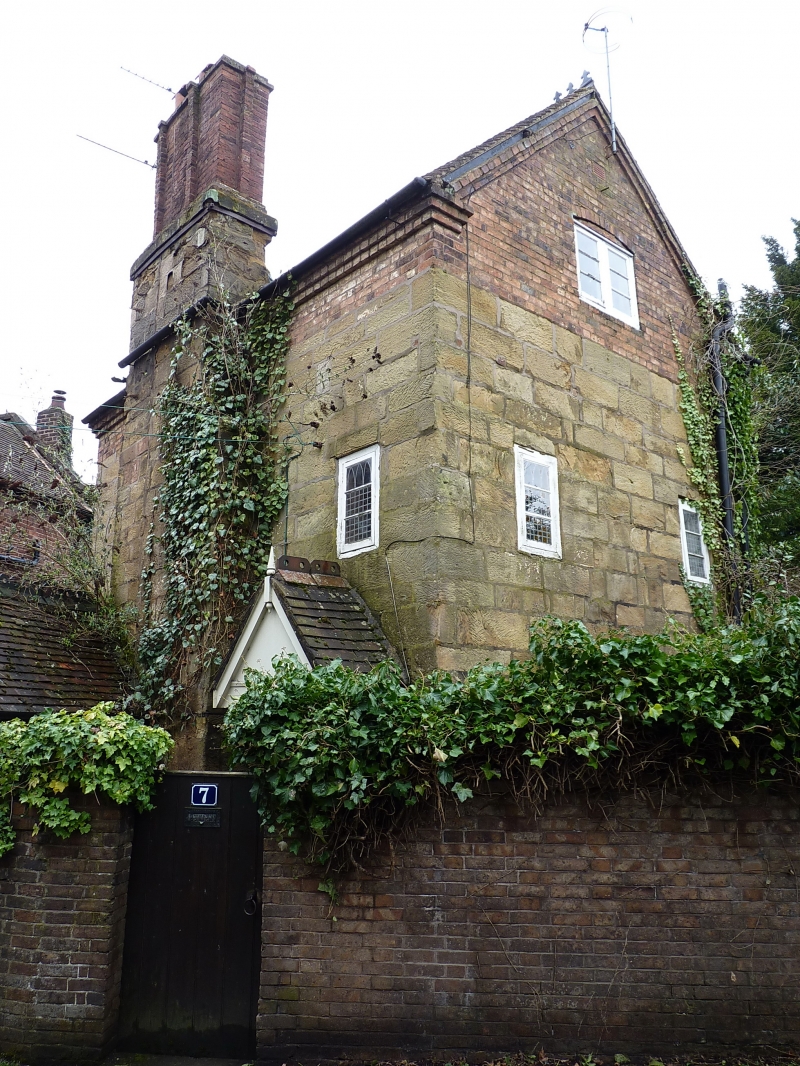
MADELEY CHURCH STREET
1.
5362 No. 7
SJ 6904SE 12/474
II GV
2.
Circa C17/18 with later alterations. Tall ashlar cottage with tile roof and brick
gables added in C19. Two-storeys. Mostly modern casements, some blocked windows.
Salient feature is the large exposed chimney breast with off-sets.
Listing NGR: SJ6952404172
External links are from the relevant listing authority and, where applicable, Wikidata. Wikidata IDs may be related buildings as well as this specific building. If you want to add or update a link, you will need to do so by editing the Wikidata entry.


Other nearby listed buildings
