Latitude: 51.293 / 51°17'34"N
Longitude: 0.4074 / 0°24'26"E
OS Eastings: 567947
OS Northings: 157626
OS Grid: TQ679576
Mapcode National: GBR NPC.V4F
Mapcode Global: VHJM5.0RQN
Plus Code: 9F327CV4+5W
Entry Name: Old Vicarage
Listing Date: 1 August 1952
Last Amended: 30 November 1993
Grade: II
Source: Historic England
Source ID: 1209099
English Heritage Legacy ID: 392377
ID on this website: 101209099
Location: West Malling, Tonbridge and Malling, Kent, ME19
County: Kent
District: Tonbridge and Malling
Civil Parish: West Malling
Built-Up Area: West Malling
Traditional County: Kent
Lieutenancy Area (Ceremonial County): Kent
Church of England Parish: West Malling St Mary
Church of England Diocese: Rochester
Tagged with: Clergy house
WEST MALLING
TQ6757 HIGH STREET 1156-0/2/61 No.126 01/08/52 Old Vicarage (Formerly Listed as: HIGH STREET The Vicarage)
GV II
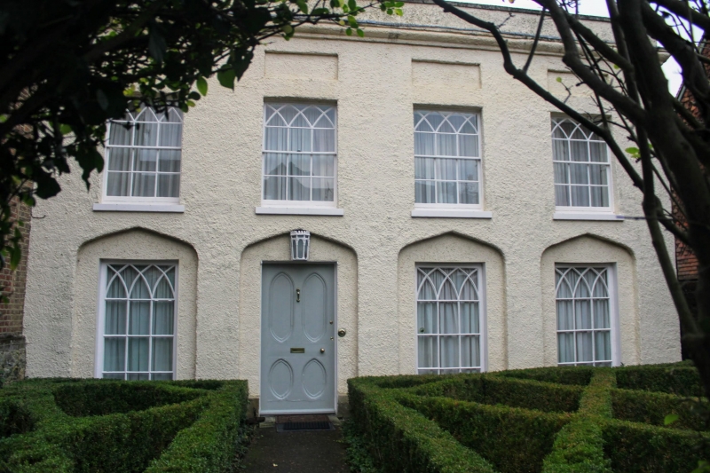
House, at one time the Vicarage. C18 or earlier refronted in roughcast and altered in Gothick style in early C19. Right side elevation red brick to ground floor, plastered above. Very steeply pitched tiled roof with tall brick chimneystack. 2 storeys 4 windows. Very tall parapet with stone coping and moulded cornice. Recessed panels above 1st floor windows. 1st floor windows have intersecting tracery. Ground floor has French windows with intersecting tracery set in 4-centred arched arcading. Original Regency period door in 2nd bay from left with 4 reed oval panels and elaborate cast-iron lamp above. Plinth.
Listing NGR: TQ6794757627
External links are from the relevant listing authority and, where applicable, Wikidata. Wikidata IDs may be related buildings as well as this specific building. If you want to add or update a link, you will need to do so by editing the Wikidata entry.


Other nearby listed buildings