Approximate Location Map
Large Map »
Latitude: 52.338 / 52°20'16"N
Longitude: -2.2778 / 2°16'40"W
OS Eastings: 381169
OS Northings: 271137
OS Grid: SO811711
Mapcode National: GBR 0C0.DXK
Mapcode Global: VH920.GHPK
Plus Code: 9C4V8PQC+5V
Entry Name: 2, 3 and 4, Mart Lane
Listing Date: 5 July 1950
Grade: II
Source: Historic England
Source ID: 1209466
English Heritage Legacy ID: 393361
ID on this website: 101209466
Location: Stourport-on-Severn, Wyre Forest, Worcestershire, DY13
County: Worcestershire
District: Wyre Forest
Civil Parish: Stourport-on-Severn
Built-Up Area: Stourport-on-Severn
Traditional County: Worcestershire
Lieutenancy Area (Ceremonial County): Worcestershire
Church of England Parish: Stourport-on-Severn and Wilden
Church of England Diocese: Worcester
Tagged with: Building
STOURPORT ON SEVERN
SO8171SW MART LANE
589-1/9/52 (East side)
05/07/50 Nos.2, 3 AND 4
GV II
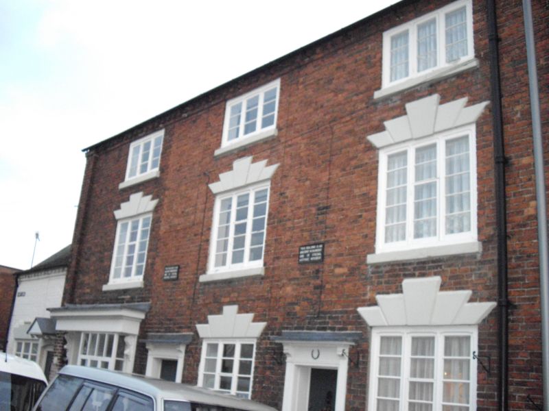
Three houses, one formerly including a shop. A single build.
c1800. Brick with plain tiled roof. 3-storeyed with basement,
6 bays. No.2 contains in its lefthand bay a narrow shop front
with architrave and cornice over doorway and projecting square
bay windows. Nos. 2-3 have 6-panelled doors with overlight in
moulded architrave, and 3-light casement windows with flat
arched stuccoed heads with stressed voussoirs and keystones.
No.4 is of 3 bays with central 6-panelled door with canopy
porch supported on moulded console brackets. 12-pane sash
windows with stuccoed flat arched heads with stressed
keystones. Angles stressed by brick pilasters. Dentilled eaves
course. Gable end stacks.
Listing NGR: SO8116971136
External links are from the relevant listing authority and, where applicable, Wikidata. Wikidata IDs may be related buildings as well as this specific building. If you want to add or update a link, you will need to do so by editing the Wikidata entry.


Other nearby listed buildings
