Latitude: 52.3387 / 52°20'19"N
Longitude: -2.2781 / 2°16'41"W
OS Eastings: 381146
OS Northings: 271211
OS Grid: SO811712
Mapcode National: GBR 0C0.6W7
Mapcode Global: VH920.GHH1
Plus Code: 9C4V8PQC+FP
Entry Name: The Lock Shop
Listing Date: 10 May 1989
Grade: II
Source: Historic England
Source ID: 1209476
English Heritage Legacy ID: 393393
ID on this website: 101209476
Location: Stourport-on-Severn, Wyre Forest, Worcestershire, DY13
County: Worcestershire
District: Wyre Forest
Civil Parish: Stourport-on-Severn
Built-Up Area: Stourport-on-Severn
Traditional County: Worcestershire
Lieutenancy Area (Ceremonial County): Worcestershire
Church of England Parish: Stourport-on-Severn and Wilden
Church of England Diocese: Worcester
Tagged with: Architectural structure
STOURPORT ON SEVERN
SO8171SW YORK STREET 589-1/0/75 (North side) 10/05/89 No.18 The Lock Shop
GV II
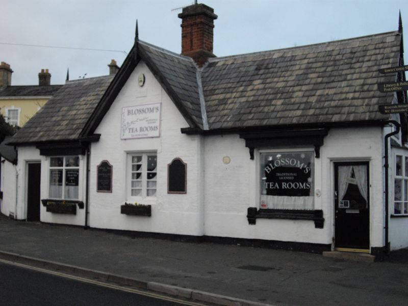
Canal Lock keepers cottage, now shop. Dated 1854. White-washed and rendered brick with Welsh slate roof and central ridge stack. Short ridge stack to left. Single-storey 3-window range with central slightly projecting gable with plaque over inscribed SWCC. Small C19 shop window to left and door beyond. Extension on left end. C20 bow window on right end with plaque over inscribed AD 1854. Extension to rear. Gable apexes have turned and pointed wooden finials. Forms a group with Toll Office(q.v.) adjacent to York Street Lock at the head of the canal basin.
Listing NGR: SO8114671211
External links are from the relevant listing authority and, where applicable, Wikidata. Wikidata IDs may be related buildings as well as this specific building. If you want to add or update a link, you will need to do so by editing the Wikidata entry.


Other nearby listed buildings