Latitude: 52.3396 / 52°20'22"N
Longitude: -2.2816 / 2°16'53"W
OS Eastings: 380910
OS Northings: 271322
OS Grid: SO809713
Mapcode National: GBR 0C0.60K
Mapcode Global: VH920.DGN8
Plus Code: 9C4V8PQ9+V9
Entry Name: 9 and 10, New Street
Listing Date: 5 July 1950
Last Amended: 11 October 1991
Grade: II
Source: Historic England
Source ID: 1209469
English Heritage Legacy ID: 393368
ID on this website: 101209469
Location: Stourport-on-Severn, Wyre Forest, Worcestershire, DY13
County: Worcestershire
District: Wyre Forest
Civil Parish: Stourport-on-Severn
Built-Up Area: Stourport-on-Severn
Traditional County: Worcestershire
Lieutenancy Area (Ceremonial County): Worcestershire
Church of England Parish: Stourport-on-Severn and Wilden
Church of England Diocese: Worcester
Tagged with: Building
STOURPORT ON SEVERN
SO8071SE NEW STREET 589-1/8/59 (North side) 05/07/50 Nos.9 AND 10 (Formerly Listed as: NEW STREET Nos.9-15 (Consecutive))
GV II
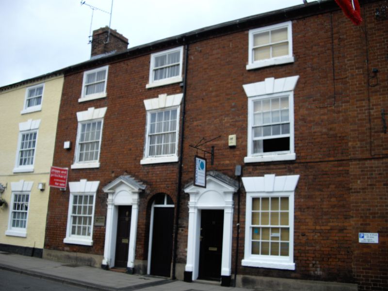
Pair of houses, now in use as offices. c1800. Brick with slate roofs. 3-storeyed, 3 bays, divided into 1 and 2 units. Each has a 6-panelled door in pedimented case and 16-pane (4-panes above) sash windows with flat arched stuccoed heads with stressed voussoirs and keystones. Modillion eaves cornice, gable end stacks.
Listing NGR: SO8091071322
External links are from the relevant listing authority and, where applicable, Wikidata. Wikidata IDs may be related buildings as well as this specific building. If you want to add or update a link, you will need to do so by editing the Wikidata entry.


Other nearby listed buildings